You are here: Home > Network List > TA - USArray Transportable Network (new EarthScope stations) Stations List
> Station BRSD Miller, SD, USA > Earthquake Result Viewer
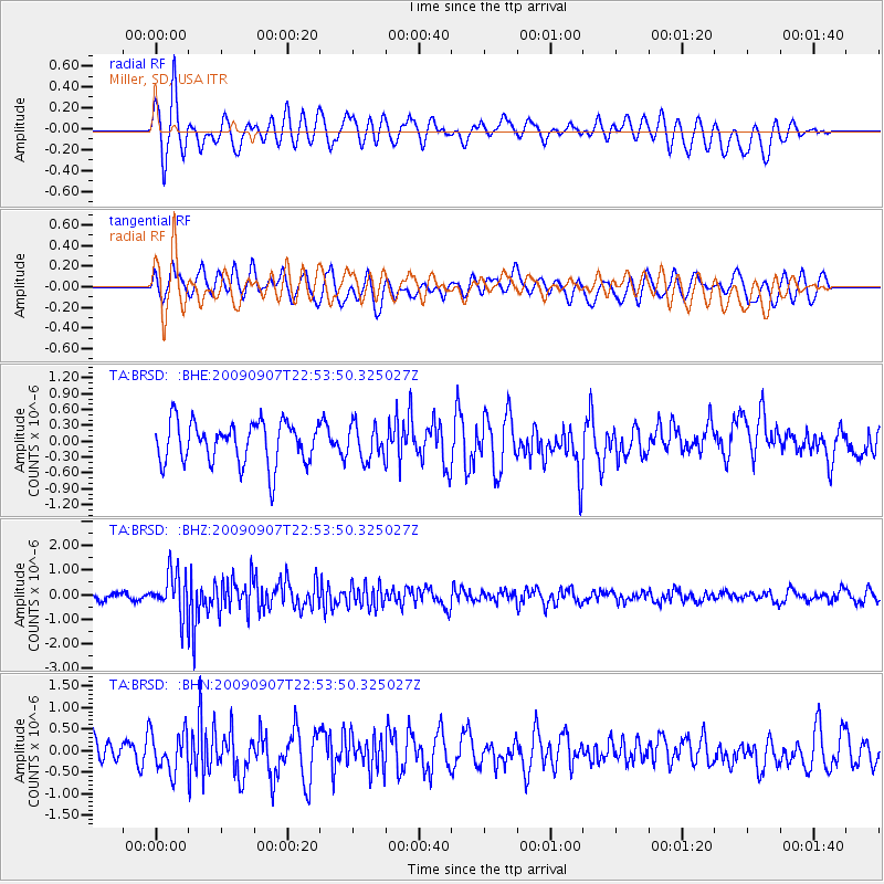
BRSD Miller, SD, USA - Earthquake Result Viewer
*The percent match for this event was below the threshold and hence no stack was calculated.
| Earthquake location: |
Northwestern Caucasus |
| Earthquake latitude/longitude: |
42.7/43.4 |
| Earthquake time(UTC): |
2009/09/07 (250) 22:41:37 GMT |
| Earthquake Depth: |
15 km |
| Earthquake Magnitude: |
5.7 MB, 5.8 MS, 6.0 MW, 5.9 MW |
| Earthquake Catalog/Contributor: |
WHDF/NEIC |
|
| Network: |
TA USArray Transportable Network (new EarthScope stations) |
| Station: |
BRSD Miller, SD, USA |
| Lat/Lon: |
44.44 N/98.96 W |
| Elevation: |
519 m |
|
| Distance: |
87.0 deg |
| Az: |
334.046 deg |
| Baz: |
26.789 deg |
| Ray Param: |
$rayparam |
*The percent match for this event was below the threshold and hence was not used in the summary stack. |
|
| Radial Match: |
59.878098 % |
| Radial Bump: |
400 |
| Transverse Match: |
49.748116 % |
| Transverse Bump: |
400 |
| SOD ConfigId: |
2622 |
| Insert Time: |
2010-03-06 19:29:22.151 +0000 |
| GWidth: |
2.5 |
| Max Bumps: |
400 |
| Tol: |
0.001 |
|
Signal To Noise
| Channel | StoN | STA | LTA |
| TA:BRSD: :BHZ:20090907T22:53:50.325027Z | 5.3054585 | 8.7344165E-7 | 1.6463076E-7 |
| TA:BRSD: :BHN:20090907T22:53:50.325027Z | 1.5905585 | 4.5706338E-7 | 2.873603E-7 |
| TA:BRSD: :BHE:20090907T22:53:50.325027Z | 0.8147217 | 3.230928E-7 | 3.9656828E-7 |
| Arrivals |
| Ps | |
| PpPs | |
| PsPs/PpSs | |


