You are here: Home > Network List > TA - USArray Transportable Network (new EarthScope stations) Stations List
> Station BRSD Miller, SD, USA > Earthquake Result Viewer
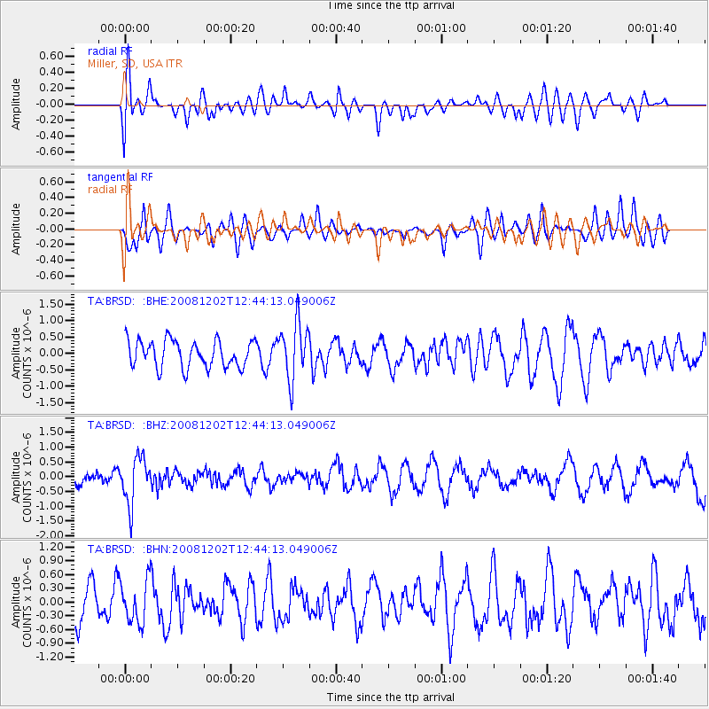
BRSD Miller, SD, USA - Earthquake Result Viewer
*The percent match for this event was below the threshold and hence no stack was calculated.
| Earthquake location: |
Mariana Islands |
| Earthquake latitude/longitude: |
19.1/145.8 |
| Earthquake time(UTC): |
2008/12/02 (337) 12:31:43 GMT |
| Earthquake Depth: |
137 km |
| Earthquake Magnitude: |
5.9 MB, 5.9 MW, 5.9 MW |
| Earthquake Catalog/Contributor: |
WHDF/NEIC |
|
| Network: |
TA USArray Transportable Network (new EarthScope stations) |
| Station: |
BRSD Miller, SD, USA |
| Lat/Lon: |
44.44 N/98.96 W |
| Elevation: |
519 m |
|
| Distance: |
93.6 deg |
| Az: |
40.458 deg |
| Baz: |
301.064 deg |
| Ray Param: |
$rayparam |
*The percent match for this event was below the threshold and hence was not used in the summary stack. |
|
| Radial Match: |
51.403805 % |
| Radial Bump: |
400 |
| Transverse Match: |
62.421925 % |
| Transverse Bump: |
400 |
| SOD ConfigId: |
2658 |
| Insert Time: |
2010-03-06 19:29:33.326 +0000 |
| GWidth: |
2.5 |
| Max Bumps: |
400 |
| Tol: |
0.001 |
|
Signal To Noise
| Channel | StoN | STA | LTA |
| TA:BRSD: :BHZ:20081202T12:44:13.049006Z | 2.2181518 | 7.909377E-7 | 3.565751E-7 |
| TA:BRSD: :BHN:20081202T12:44:13.049006Z | 1.0683618 | 4.6133755E-7 | 4.3181774E-7 |
| TA:BRSD: :BHE:20081202T12:44:13.049006Z | 2.1056464 | 8.673913E-7 | 4.1193587E-7 |
| Arrivals |
| Ps | |
| PpPs | |
| PsPs/PpSs | |


