You are here: Home > Network List > TA - USArray Transportable Network (new EarthScope stations) Stations List
> Station F21K Alatna River, AK, USA > Earthquake Result Viewer
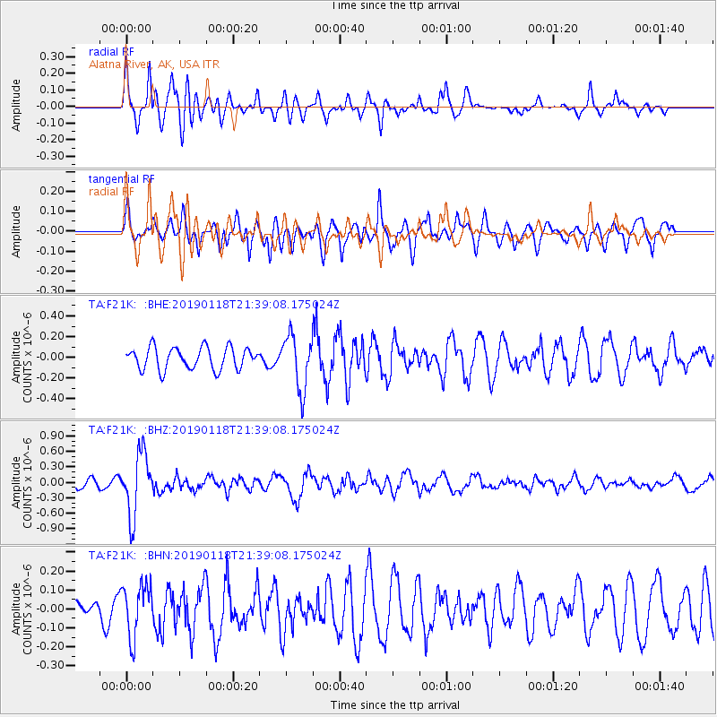
F21K Alatna River, AK, USA - Earthquake Result Viewer
*The percent match for this event was below the threshold and hence no stack was calculated.
| Earthquake location: |
Northern Peru |
| Earthquake latitude/longitude: |
-3.3/-76.9 |
| Earthquake time(UTC): |
2019/01/18 (018) 21:27:01 GMT |
| Earthquake Depth: |
103 km |
| Earthquake Magnitude: |
5.7 Mww |
| Earthquake Catalog/Contributor: |
NEIC PDE/us |
|
| Network: |
TA USArray Transportable Network (new EarthScope stations) |
| Station: |
F21K Alatna River, AK, USA |
| Lat/Lon: |
67.22 N/153.48 W |
| Elevation: |
597 m |
|
| Distance: |
87.9 deg |
| Az: |
337.723 deg |
| Baz: |
103.596 deg |
| Ray Param: |
$rayparam |
*The percent match for this event was below the threshold and hence was not used in the summary stack. |
|
| Radial Match: |
64.39966 % |
| Radial Bump: |
400 |
| Transverse Match: |
63.74204 % |
| Transverse Bump: |
400 |
| SOD ConfigId: |
13570011 |
| Insert Time: |
2019-05-02 08:20:34.879 +0000 |
| GWidth: |
2.5 |
| Max Bumps: |
400 |
| Tol: |
0.001 |
|
Signal To Noise
| Channel | StoN | STA | LTA |
| TA:F21K: :BHZ:20190118T21:39:08.175024Z | 5.350532 | 6.055305E-7 | 1.13172014E-7 |
| TA:F21K: :BHN:20190118T21:39:08.175024Z | 1.2381868 | 1.3848724E-7 | 1.118468E-7 |
| TA:F21K: :BHE:20190118T21:39:08.175024Z | 2.4765959 | 2.6212584E-7 | 1.0584118E-7 |
| Arrivals |
| Ps | |
| PpPs | |
| PsPs/PpSs | |


