You are here: Home > Network List > TA - USArray Transportable Network (new EarthScope stations) Stations List
> Station G21K Allakaket, AK, USA > Earthquake Result Viewer
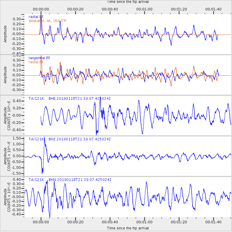
G21K Allakaket, AK, USA - Earthquake Result Viewer
*The percent match for this event was below the threshold and hence no stack was calculated.
| Earthquake location: |
Northern Peru |
| Earthquake latitude/longitude: |
-3.3/-76.9 |
| Earthquake time(UTC): |
2019/01/18 (018) 21:27:01 GMT |
| Earthquake Depth: |
103 km |
| Earthquake Magnitude: |
5.7 Mww |
| Earthquake Catalog/Contributor: |
NEIC PDE/us |
|
| Network: |
TA USArray Transportable Network (new EarthScope stations) |
| Station: |
G21K Allakaket, AK, USA |
| Lat/Lon: |
66.52 N/153.51 W |
| Elevation: |
446 m |
|
| Distance: |
87.7 deg |
| Az: |
337.03 deg |
| Baz: |
103.548 deg |
| Ray Param: |
$rayparam |
*The percent match for this event was below the threshold and hence was not used in the summary stack. |
|
| Radial Match: |
70.894844 % |
| Radial Bump: |
340 |
| Transverse Match: |
56.635788 % |
| Transverse Bump: |
385 |
| SOD ConfigId: |
13570011 |
| Insert Time: |
2019-05-02 08:20:43.582 +0000 |
| GWidth: |
2.5 |
| Max Bumps: |
400 |
| Tol: |
0.001 |
|
Signal To Noise
| Channel | StoN | STA | LTA |
| TA:G21K: :BHZ:20190118T21:39:07.425024Z | 7.101223 | 7.6668545E-7 | 1.0796526E-7 |
| TA:G21K: :BHN:20190118T21:39:07.425024Z | 1.9348772 | 2.2201372E-7 | 1.1474305E-7 |
| TA:G21K: :BHE:20190118T21:39:07.425024Z | 1.8465458 | 2.9088494E-7 | 1.5752924E-7 |
| Arrivals |
| Ps | |
| PpPs | |
| PsPs/PpSs | |


