You are here: Home > Network List > TA - USArray Transportable Network (new EarthScope stations) Stations List
> Station BRSD Miller, SD, USA > Earthquake Result Viewer
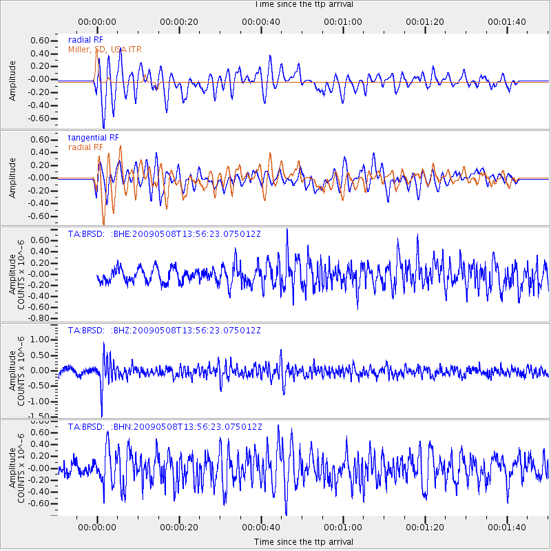
BRSD Miller, SD, USA - Earthquake Result Viewer
*The percent match for this event was below the threshold and hence no stack was calculated.
| Earthquake location: |
Mendoza Province, Argentina |
| Earthquake latitude/longitude: |
-32.1/-69.7 |
| Earthquake time(UTC): |
2009/05/08 (128) 13:44:53 GMT |
| Earthquake Depth: |
112 km |
| Earthquake Magnitude: |
5.6 MB, 5.4 MW |
| Earthquake Catalog/Contributor: |
WHDF/NEIC |
|
| Network: |
TA USArray Transportable Network (new EarthScope stations) |
| Station: |
BRSD Miller, SD, USA |
| Lat/Lon: |
44.44 N/98.96 W |
| Elevation: |
519 m |
|
| Distance: |
80.7 deg |
| Az: |
339.207 deg |
| Baz: |
155.114 deg |
| Ray Param: |
$rayparam |
*The percent match for this event was below the threshold and hence was not used in the summary stack. |
|
| Radial Match: |
70.493904 % |
| Radial Bump: |
400 |
| Transverse Match: |
59.460537 % |
| Transverse Bump: |
400 |
| SOD ConfigId: |
2658 |
| Insert Time: |
2010-03-06 19:29:52.312 +0000 |
| GWidth: |
2.5 |
| Max Bumps: |
400 |
| Tol: |
0.001 |
|
Signal To Noise
| Channel | StoN | STA | LTA |
| TA:BRSD: :BHZ:20090508T13:56:23.075012Z | 4.276072 | 4.3115142E-7 | 1.00828856E-7 |
| TA:BRSD: :BHN:20090508T13:56:23.075012Z | 1.9579506 | 2.838236E-7 | 1.4495953E-7 |
| TA:BRSD: :BHE:20090508T13:56:23.075012Z | 1.7086543 | 2.020616E-7 | 1.18257745E-7 |
| Arrivals |
| Ps | |
| PpPs | |
| PsPs/PpSs | |


