You are here: Home > Network List > TA - USArray Transportable Network (new EarthScope stations) Stations List
> Station R33M Jennings River, BC, CAN > Earthquake Result Viewer
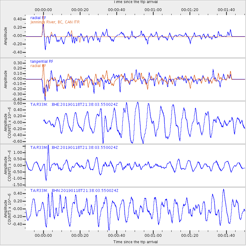
R33M Jennings River, BC, CAN - Earthquake Result Viewer
*The percent match for this event was below the threshold and hence no stack was calculated.
| Earthquake location: |
Northern Peru |
| Earthquake latitude/longitude: |
-3.3/-76.9 |
| Earthquake time(UTC): |
2019/01/18 (018) 21:27:01 GMT |
| Earthquake Depth: |
103 km |
| Earthquake Magnitude: |
5.7 Mww |
| Earthquake Catalog/Contributor: |
NEIC PDE/us |
|
| Network: |
TA USArray Transportable Network (new EarthScope stations) |
| Station: |
R33M Jennings River, BC, CAN |
| Lat/Lon: |
59.39 N/130.97 W |
| Elevation: |
1437 m |
|
| Distance: |
75.5 deg |
| Az: |
334.649 deg |
| Baz: |
123.337 deg |
| Ray Param: |
$rayparam |
*The percent match for this event was below the threshold and hence was not used in the summary stack. |
|
| Radial Match: |
58.966755 % |
| Radial Bump: |
400 |
| Transverse Match: |
77.21379 % |
| Transverse Bump: |
360 |
| SOD ConfigId: |
13570011 |
| Insert Time: |
2019-05-02 08:21:52.520 +0000 |
| GWidth: |
2.5 |
| Max Bumps: |
400 |
| Tol: |
0.001 |
|
Signal To Noise
| Channel | StoN | STA | LTA |
| TA:R33M: :BHZ:20190118T21:38:03.550024Z | 2.4274538 | 6.4183683E-7 | 2.6440742E-7 |
| TA:R33M: :BHN:20190118T21:38:03.550024Z | 1.1717697 | 2.5622518E-7 | 2.1866512E-7 |
| TA:R33M: :BHE:20190118T21:38:03.550024Z | 1.796957 | 3.1124725E-7 | 1.7320797E-7 |
| Arrivals |
| Ps | |
| PpPs | |
| PsPs/PpSs | |


