You are here: Home > Network List > UW - Pacific Northwest Regional Seismic Network Stations List
> Station UMAT Pilot Rock, OR, USA > Earthquake Result Viewer
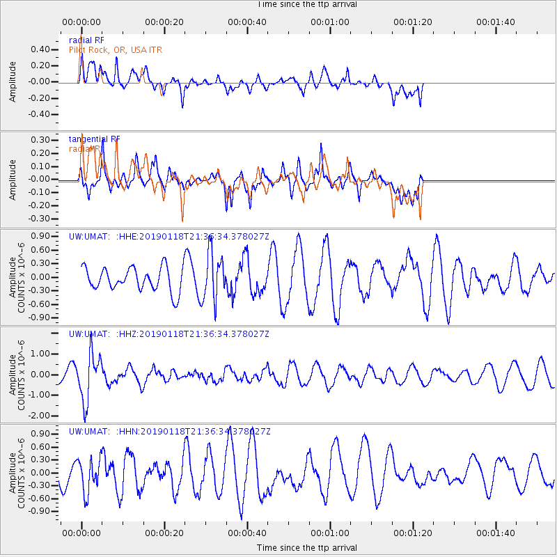
UMAT Pilot Rock, OR, USA - Earthquake Result Viewer
*The percent match for this event was below the threshold and hence no stack was calculated.
| Earthquake location: |
Northern Peru |
| Earthquake latitude/longitude: |
-3.3/-76.9 |
| Earthquake time(UTC): |
2019/01/18 (018) 21:27:01 GMT |
| Earthquake Depth: |
103 km |
| Earthquake Magnitude: |
5.7 Mww |
| Earthquake Catalog/Contributor: |
NEIC PDE/us |
|
| Network: |
UW Pacific Northwest Regional Seismic Network |
| Station: |
UMAT Pilot Rock, OR, USA |
| Lat/Lon: |
45.29 N/118.96 W |
| Elevation: |
1318 m |
|
| Distance: |
61.2 deg |
| Az: |
327.295 deg |
| Baz: |
130.166 deg |
| Ray Param: |
$rayparam |
*The percent match for this event was below the threshold and hence was not used in the summary stack. |
|
| Radial Match: |
57.348446 % |
| Radial Bump: |
400 |
| Transverse Match: |
80.245926 % |
| Transverse Bump: |
373 |
| SOD ConfigId: |
13570011 |
| Insert Time: |
2019-05-02 08:22:40.423 +0000 |
| GWidth: |
2.5 |
| Max Bumps: |
400 |
| Tol: |
0.001 |
|
Signal To Noise
| Channel | StoN | STA | LTA |
| UW:UMAT: :HHZ:20190118T21:36:34.378027Z | 3.413073 | 1.1652652E-6 | 3.414123E-7 |
| UW:UMAT: :HHN:20190118T21:36:34.378027Z | 1.2459153 | 3.865765E-7 | 3.1027508E-7 |
| UW:UMAT: :HHE:20190118T21:36:34.378027Z | 2.061112 | 5.3189723E-7 | 2.5806324E-7 |
| Arrivals |
| Ps | |
| PpPs | |
| PsPs/PpSs | |


