You are here: Home > Network List > TA - USArray Transportable Network (new EarthScope stations) Stations List
> Station M25A Palm-Egli Farm, Albin, WY, USA > Earthquake Result Viewer
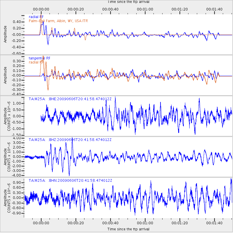
M25A Palm-Egli Farm, Albin, WY, USA - Earthquake Result Viewer
*The percent match for this event was below the threshold and hence no stack was calculated.
| Earthquake location: |
Northern Mid-Atlantic Ridge |
| Earthquake latitude/longitude: |
23.9/-46.1 |
| Earthquake time(UTC): |
2009/06/06 (157) 20:33:28 GMT |
| Earthquake Depth: |
14 km |
| Earthquake Magnitude: |
6.0 MB, 5.7 MS, 6.0 MW, 6.0 MW |
| Earthquake Catalog/Contributor: |
WHDF/NEIC |
|
| Network: |
TA USArray Transportable Network (new EarthScope stations) |
| Station: |
M25A Palm-Egli Farm, Albin, WY, USA |
| Lat/Lon: |
41.43 N/104.06 W |
| Elevation: |
1636 m |
|
| Distance: |
50.9 deg |
| Az: |
304.806 deg |
| Baz: |
91.314 deg |
| Ray Param: |
$rayparam |
*The percent match for this event was below the threshold and hence was not used in the summary stack. |
|
| Radial Match: |
77.63472 % |
| Radial Bump: |
400 |
| Transverse Match: |
64.75431 % |
| Transverse Bump: |
400 |
| SOD ConfigId: |
2648 |
| Insert Time: |
2010-03-06 19:31:04.477 +0000 |
| GWidth: |
2.5 |
| Max Bumps: |
400 |
| Tol: |
0.001 |
|
Signal To Noise
| Channel | StoN | STA | LTA |
| TA:M25A: :BHZ:20090606T20:41:58.474012Z | 5.791833 | 7.896351E-7 | 1.3633597E-7 |
| TA:M25A: :BHN:20090606T20:41:58.474012Z | 1.0927287 | 2.0772943E-7 | 1.9010155E-7 |
| TA:M25A: :BHE:20090606T20:41:58.474012Z | 1.1108327 | 3.0947518E-7 | 2.785975E-7 |
| Arrivals |
| Ps | |
| PpPs | |
| PsPs/PpSs | |


