You are here: Home > Network List > GS - US Geological Survey Networks Stations List
> Station OK045 Pawnee, OK, Station 45 > Earthquake Result Viewer
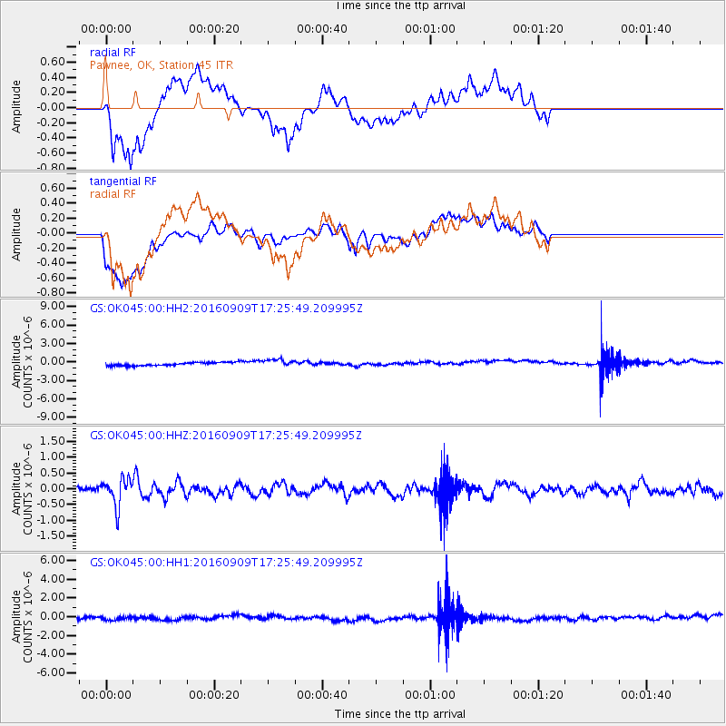
OK045 Pawnee, OK, Station 45 - Earthquake Result Viewer
*The percent match for this event was below the threshold and hence no stack was calculated.
| Earthquake location: |
Northern Mid-Atlantic Ridge |
| Earthquake latitude/longitude: |
22.1/-45.9 |
| Earthquake time(UTC): |
2016/09/09 (253) 17:17:54 GMT |
| Earthquake Depth: |
10 km |
| Earthquake Magnitude: |
5.5 MB |
| Earthquake Catalog/Contributor: |
NEIC PDE/NEIC COMCAT |
|
| Network: |
GS US Geological Survey Networks |
| Station: |
OK045 Pawnee, OK, Station 45 |
| Lat/Lon: |
36.45 N/96.92 W |
| Elevation: |
284 m |
|
| Distance: |
46.3 deg |
| Az: |
299.78 deg |
| Baz: |
93.408 deg |
| Ray Param: |
$rayparam |
*The percent match for this event was below the threshold and hence was not used in the summary stack. |
|
| Radial Match: |
41.238995 % |
| Radial Bump: |
400 |
| Transverse Match: |
53.270435 % |
| Transverse Bump: |
400 |
| SOD ConfigId: |
1634031 |
| Insert Time: |
2016-09-23 17:20:46.848 +0000 |
| GWidth: |
2.5 |
| Max Bumps: |
400 |
| Tol: |
0.001 |
|
Signal To Noise
| Channel | StoN | STA | LTA |
| GS:OK045:00:HHZ:20160909T17:25:49.209995Z | 4.3108325 | 4.404957E-7 | 1.02183435E-7 |
| GS:OK045:00:HH1:20160909T17:25:49.209995Z | 1.3260322 | 2.317574E-7 | 1.7477508E-7 |
| GS:OK045:00:HH2:20160909T17:25:49.209995Z | 2.291084 | 6.042077E-7 | 2.6372132E-7 |
| Arrivals |
| Ps | |
| PpPs | |
| PsPs/PpSs | |


