F24A Ekalaka, MT, USA - Earthquake Result Viewer
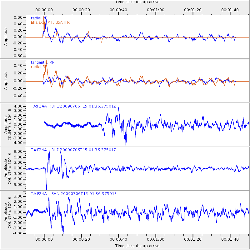
Earthquake location: Rat Islands, Aleutian Islands
Earthquake latitude/longitude: 50.4/177.0
Earthquake time(UTC): 2009/07/06 (187) 14:53:12 GMT
Earthquake Depth: 22 km
Earthquake Magnitude: 6.0 MB, 5.8 MS, 6.1 MW, 6.0 MW
Earthquake Catalog/Contributor: WHDF/NEIC
Network: TA USArray Transportable Network (new EarthScope stations)
Station: F24A Ekalaka, MT, USA
Lat/Lon: 45.85 N/104.44 W
Elevation: 1105 m
Distance: 50.3 deg
Az: 62.889 deg
Baz: 305.477 deg
Ray Param: 0.06810052
Estimated Moho Depth: 58.25 km
Estimated Crust Vp/Vs: 1.64
Assumed Crust Vp: 6.242 km/s
Estimated Crust Vs: 3.806 km/s
Estimated Crust Poisson's Ratio: 0.20
Radial Match: 89.3208 %
Radial Bump: 400
Transverse Match: 74.96799 %
Transverse Bump: 400
SOD ConfigId: 2648
Insert Time: 2010-03-06 19:34:09.052 +0000
GWidth: 2.5
Max Bumps: 400
Tol: 0.001

Signal To Noise

ChannelStoNSTALTA
TA:F24A: :BHZ:20090706T15:01:36.37501Z16.4632364.2877127E-62.6044168E-7
TA:F24A: :BHN:20090706T15:01:36.37501Z4.33161351.1808501E-62.7261206E-7
TA:F24A: :BHE:20090706T15:01:36.37501Z3.63770131.1547232E-63.1743213E-7
Arrivals
Ps6.3 SECOND
PpPs23 SECOND
PsPs/PpSs30 SECOND