You are here: Home > Network List > TS - TERRAscope (Southern California Seismic Network) Stations List
> Station CALB Calabasas, California, USA > Earthquake Result Viewer
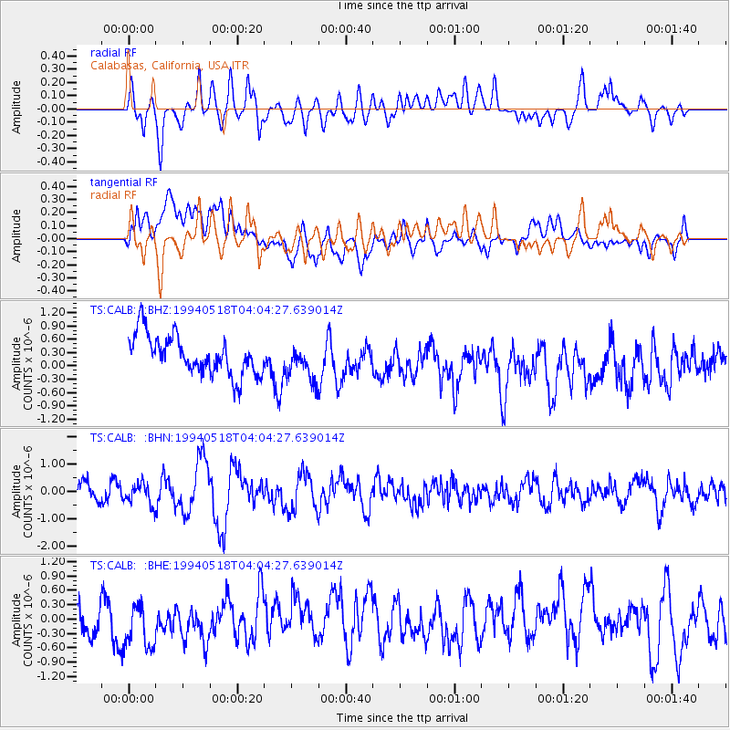
CALB Calabasas, California, USA - Earthquake Result Viewer
*The percent match for this event was below the threshold and hence no stack was calculated.
| Earthquake location: |
Kuril Islands |
| Earthquake latitude/longitude: |
44.7/149.4 |
| Earthquake time(UTC): |
1994/05/18 (138) 03:54:02 GMT |
| Earthquake Depth: |
46 km |
| Earthquake Magnitude: |
5.8 MB, 5.8 MS, 5.5 UNKNOWN, 6.2 MW |
| Earthquake Catalog/Contributor: |
WHDF/NEIC |
|
| Network: |
TS TERRAscope (Southern California Seismic Network) |
| Station: |
CALB Calabasas, California, USA |
| Lat/Lon: |
34.14 N/118.63 W |
| Elevation: |
0.0 m |
|
| Distance: |
68.2 deg |
| Az: |
63.236 deg |
| Baz: |
309.826 deg |
| Ray Param: |
$rayparam |
*The percent match for this event was below the threshold and hence was not used in the summary stack. |
|
| Radial Match: |
72.5979 % |
| Radial Bump: |
400 |
| Transverse Match: |
58.3625 % |
| Transverse Bump: |
400 |
| SOD ConfigId: |
4480 |
| Insert Time: |
2010-02-26 14:04:03.320 +0000 |
| GWidth: |
2.5 |
| Max Bumps: |
400 |
| Tol: |
0.001 |
|
Signal To Noise
| Channel | StoN | STA | LTA |
| TS:CALB: :BHN:19940518T04:04:27.639014Z | 1.2651142 | 3.8522063E-7 | 3.0449473E-7 |
| TS:CALB: :BHE:19940518T04:04:27.639014Z | 2.0905666 | 5.825962E-7 | 2.7867864E-7 |
| TS:CALB: :BHZ:19940518T04:04:27.639014Z | 0.9248317 | 4.0429902E-7 | 4.3715954E-7 |
| Arrivals |
| Ps | |
| PpPs | |
| PsPs/PpSs | |


