You are here: Home > Network List > TA - USArray Transportable Network (new EarthScope stations) Stations List
> Station 121A Cookes Peak, Deming, NM, USA > Earthquake Result Viewer
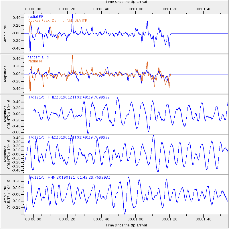
121A Cookes Peak, Deming, NM, USA - Earthquake Result Viewer
*The percent match for this event was below the threshold and hence no stack was calculated.
| Earthquake location: |
Southeast Of Loyalty Islands |
| Earthquake latitude/longitude: |
-21.9/169.1 |
| Earthquake time(UTC): |
2019/01/21 (021) 01:36:36 GMT |
| Earthquake Depth: |
10 km |
| Earthquake Magnitude: |
5.7 Mww |
| Earthquake Catalog/Contributor: |
NEIC PDE/us |
|
| Network: |
TA USArray Transportable Network (new EarthScope stations) |
| Station: |
121A Cookes Peak, Deming, NM, USA |
| Lat/Lon: |
32.53 N/107.79 W |
| Elevation: |
1652 m |
|
| Distance: |
96.0 deg |
| Az: |
57.474 deg |
| Baz: |
248.007 deg |
| Ray Param: |
$rayparam |
*The percent match for this event was below the threshold and hence was not used in the summary stack. |
|
| Radial Match: |
56.512527 % |
| Radial Bump: |
400 |
| Transverse Match: |
50.282387 % |
| Transverse Bump: |
368 |
| SOD ConfigId: |
13570011 |
| Insert Time: |
2019-05-02 08:44:15.264 +0000 |
| GWidth: |
2.5 |
| Max Bumps: |
400 |
| Tol: |
0.001 |
|
Signal To Noise
| Channel | StoN | STA | LTA |
| TA:121A: :HHZ:20190121T01:49:29.769993Z | 1.1715512 | 2.3793747E-7 | 2.0309609E-7 |
| TA:121A: :HHN:20190121T01:49:29.769993Z | 0.86479115 | 9.3096084E-8 | 1.07651516E-7 |
| TA:121A: :HHE:20190121T01:49:29.769993Z | 3.0715613 | 3.54961E-7 | 1.155637E-7 |
| Arrivals |
| Ps | |
| PpPs | |
| PsPs/PpSs | |


