You are here: Home > Network List > TA - USArray Transportable Network (new EarthScope stations) Stations List
> Station F24A Ekalaka, MT, USA > Earthquake Result Viewer
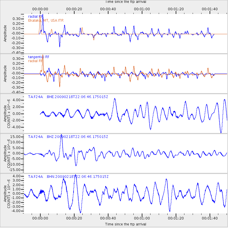
F24A Ekalaka, MT, USA - Earthquake Result Viewer
*The percent match for this event was below the threshold and hence no stack was calculated.
| Earthquake location: |
Kermadec Islands Region |
| Earthquake latitude/longitude: |
-27.4/-176.3 |
| Earthquake time(UTC): |
2009/02/18 (049) 21:53:45 GMT |
| Earthquake Depth: |
25 km |
| Earthquake Magnitude: |
6.8 MB, 7.2 MS, 6.9 MW, 6.9 MW |
| Earthquake Catalog/Contributor: |
WHDF/NEIC |
|
| Network: |
TA USArray Transportable Network (new EarthScope stations) |
| Station: |
F24A Ekalaka, MT, USA |
| Lat/Lon: |
45.85 N/104.44 W |
| Elevation: |
1105 m |
|
| Distance: |
97.7 deg |
| Az: |
42.101 deg |
| Baz: |
238.492 deg |
| Ray Param: |
$rayparam |
*The percent match for this event was below the threshold and hence was not used in the summary stack. |
|
| Radial Match: |
88.96325 % |
| Radial Bump: |
305 |
| Transverse Match: |
71.96133 % |
| Transverse Bump: |
255 |
| SOD ConfigId: |
2658 |
| Insert Time: |
2010-03-06 19:34:40.301 +0000 |
| GWidth: |
2.5 |
| Max Bumps: |
400 |
| Tol: |
0.001 |
|
Signal To Noise
| Channel | StoN | STA | LTA |
| TA:F24A: :BHZ:20090218T22:06:46.175015Z | 3.1240218 | 1.0127255E-6 | 3.2417364E-7 |
| TA:F24A: :BHN:20090218T22:06:46.175015Z | 1.2219675 | 8.536806E-7 | 6.986116E-7 |
| TA:F24A: :BHE:20090218T22:06:46.175015Z | 1.1300204 | 7.0356907E-7 | 6.226163E-7 |
| Arrivals |
| Ps | |
| PpPs | |
| PsPs/PpSs | |


