You are here: Home > Network List > CN - Canadian National Seismograph Network Stations List
> Station INK INUVIK, NT > Earthquake Result Viewer
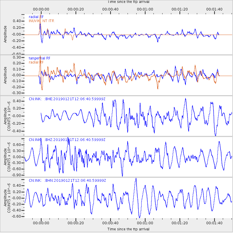
INK INUVIK, NT - Earthquake Result Viewer
*The percent match for this event was below the threshold and hence no stack was calculated.
| Earthquake location: |
Near Coast Of Oaxaca, Mexico |
| Earthquake latitude/longitude: |
15.6/-94.7 |
| Earthquake time(UTC): |
2019/01/21 (021) 11:57:17 GMT |
| Earthquake Depth: |
10 km |
| Earthquake Magnitude: |
5.8 Mww |
| Earthquake Catalog/Contributor: |
NEIC PDE/us |
|
| Network: |
CN Canadian National Seismograph Network |
| Station: |
INK INUVIK, NT |
| Lat/Lon: |
68.31 N/133.53 W |
| Elevation: |
44 m |
|
| Distance: |
58.2 deg |
| Az: |
344.093 deg |
| Baz: |
134.725 deg |
| Ray Param: |
$rayparam |
*The percent match for this event was below the threshold and hence was not used in the summary stack. |
|
| Radial Match: |
43.49387 % |
| Radial Bump: |
400 |
| Transverse Match: |
41.041603 % |
| Transverse Bump: |
400 |
| SOD ConfigId: |
13570011 |
| Insert Time: |
2019-05-02 08:47:31.416 +0000 |
| GWidth: |
2.5 |
| Max Bumps: |
400 |
| Tol: |
0.001 |
|
Signal To Noise
| Channel | StoN | STA | LTA |
| CN:INK: :BHZ:20190121T12:06:40.59999Z | 2.43259 | 4.2743085E-7 | 1.7571018E-7 |
| CN:INK: :BHN:20190121T12:06:40.59999Z | 0.6187732 | 1.7202177E-7 | 2.7800453E-7 |
| CN:INK: :BHE:20190121T12:06:40.59999Z | 1.7509657 | 1.5331553E-7 | 8.756055E-8 |
| Arrivals |
| Ps | |
| PpPs | |
| PsPs/PpSs | |


