You are here: Home > Network List > TS - TERRAscope (Southern California Seismic Network) Stations List
> Station CALB Calabasas, California, USA > Earthquake Result Viewer
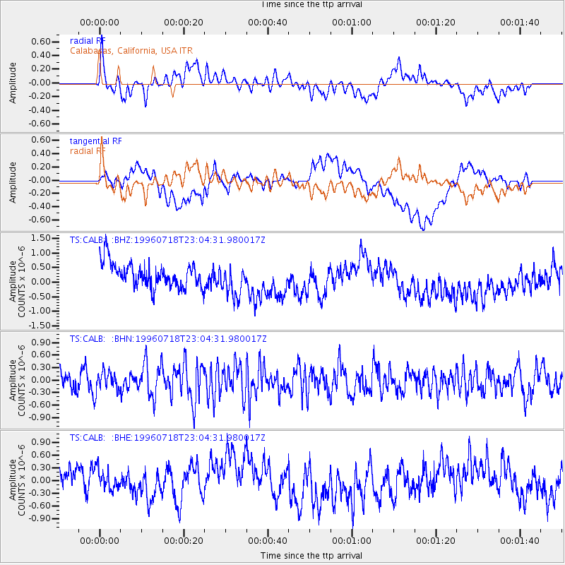
CALB Calabasas, California, USA - Earthquake Result Viewer
*The percent match for this event was below the threshold and hence no stack was calculated.
| Earthquake location: |
Off East Coast Of Kamchatka |
| Earthquake latitude/longitude: |
51.5/159.4 |
| Earthquake time(UTC): |
1996/07/18 (200) 22:55:03 GMT |
| Earthquake Depth: |
33 km |
| Earthquake Magnitude: |
5.5 MB, 5.2 MS |
| Earthquake Catalog/Contributor: |
WHDF/NEIC |
|
| Network: |
TS TERRAscope (Southern California Seismic Network) |
| Station: |
CALB Calabasas, California, USA |
| Lat/Lon: |
34.14 N/118.63 W |
| Elevation: |
0.0 m |
|
| Distance: |
59.4 deg |
| Az: |
72.533 deg |
| Baz: |
314.028 deg |
| Ray Param: |
$rayparam |
*The percent match for this event was below the threshold and hence was not used in the summary stack. |
|
| Radial Match: |
36.21016 % |
| Radial Bump: |
400 |
| Transverse Match: |
31.814108 % |
| Transverse Bump: |
400 |
| SOD ConfigId: |
4480 |
| Insert Time: |
2010-02-26 14:04:09.851 +0000 |
| GWidth: |
2.5 |
| Max Bumps: |
400 |
| Tol: |
0.001 |
|
Signal To Noise
| Channel | StoN | STA | LTA |
| TS:CALB: :BHN:19960718T23:04:31.980017Z | 1.0552406 | 2.2095686E-7 | 2.0939002E-7 |
| TS:CALB: :BHE:19960718T23:04:31.980017Z | 0.69322854 | 2.9603757E-7 | 4.2704184E-7 |
| TS:CALB: :BHZ:19960718T23:04:31.980017Z | 1.3599027 | 5.630024E-7 | 4.1400196E-7 |
| Arrivals |
| Ps | |
| PpPs | |
| PsPs/PpSs | |


