You are here: Home > Network List > TA - USArray Transportable Network (new EarthScope stations) Stations List
> Station F24A Ekalaka, MT, USA > Earthquake Result Viewer
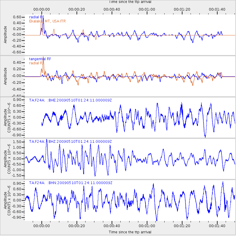
F24A Ekalaka, MT, USA - Earthquake Result Viewer
*The percent match for this event was below the threshold and hence no stack was calculated.
| Earthquake location: |
Off Coast Of Ecuador |
| Earthquake latitude/longitude: |
1.4/-85.2 |
| Earthquake time(UTC): |
2009/05/10 (130) 01:16:06 GMT |
| Earthquake Depth: |
6.0 km |
| Earthquake Magnitude: |
5.5 MB, 5.7 MS, 6.1 MW, 6.1 MW |
| Earthquake Catalog/Contributor: |
WHDF/NEIC |
|
| Network: |
TA USArray Transportable Network (new EarthScope stations) |
| Station: |
F24A Ekalaka, MT, USA |
| Lat/Lon: |
45.85 N/104.44 W |
| Elevation: |
1105 m |
|
| Distance: |
47.4 deg |
| Az: |
341.73 deg |
| Baz: |
153.362 deg |
| Ray Param: |
$rayparam |
*The percent match for this event was below the threshold and hence was not used in the summary stack. |
|
| Radial Match: |
78.23247 % |
| Radial Bump: |
400 |
| Transverse Match: |
52.823753 % |
| Transverse Bump: |
325 |
| SOD ConfigId: |
2760 |
| Insert Time: |
2010-03-06 19:35:37.703 +0000 |
| GWidth: |
2.5 |
| Max Bumps: |
400 |
| Tol: |
0.001 |
|
Signal To Noise
| Channel | StoN | STA | LTA |
| TA:F24A: :BHZ:20090510T01:24:11.000009Z | 4.418587 | 6.8474264E-7 | 1.5496867E-7 |
| TA:F24A: :BHN:20090510T01:24:11.000009Z | 0.97176635 | 2.5697793E-7 | 2.6444414E-7 |
| TA:F24A: :BHE:20090510T01:24:11.000009Z | 0.42700773 | 1.04125704E-7 | 2.4384968E-7 |
| Arrivals |
| Ps | |
| PpPs | |
| PsPs/PpSs | |


