You are here: Home > Network List > TA - USArray Transportable Network (new EarthScope stations) Stations List
> Station F23A Volborg, MT, USA > Earthquake Result Viewer
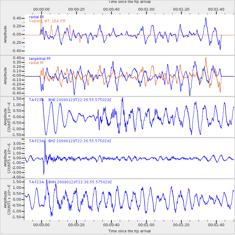
F23A Volborg, MT, USA - Earthquake Result Viewer
*The percent match for this event was below the threshold and hence no stack was calculated.
| Earthquake location: |
Western Brazil |
| Earthquake latitude/longitude: |
-8.1/-71.4 |
| Earthquake time(UTC): |
2009/01/29 (029) 22:28:05 GMT |
| Earthquake Depth: |
602 km |
| Earthquake Magnitude: |
5.7 MW, 5.3 MB, 5.6 MW |
| Earthquake Catalog/Contributor: |
WHDF/NEIC |
|
| Network: |
TA USArray Transportable Network (new EarthScope stations) |
| Station: |
F23A Volborg, MT, USA |
| Lat/Lon: |
45.72 N/105.41 W |
| Elevation: |
953 m |
|
| Distance: |
61.6 deg |
| Az: |
333.562 deg |
| Baz: |
141.004 deg |
| Ray Param: |
$rayparam |
*The percent match for this event was below the threshold and hence was not used in the summary stack. |
|
| Radial Match: |
37.68915 % |
| Radial Bump: |
334 |
| Transverse Match: |
43.01519 % |
| Transverse Bump: |
325 |
| SOD ConfigId: |
2658 |
| Insert Time: |
2010-03-06 19:37:28.250 +0000 |
| GWidth: |
2.5 |
| Max Bumps: |
400 |
| Tol: |
0.001 |
|
Signal To Noise
| Channel | StoN | STA | LTA |
| TA:F23A: :BHZ:20090129T22:36:55.575029Z | 4.0014043 | 1.2976112E-6 | 3.2428898E-7 |
| TA:F23A: :BHN:20090129T22:36:55.575029Z | 1.5046078 | 6.968713E-7 | 4.6315813E-7 |
| TA:F23A: :BHE:20090129T22:36:55.575029Z | 0.45093048 | 3.2599922E-7 | 7.2294785E-7 |
| Arrivals |
| Ps | |
| PpPs | |
| PsPs/PpSs | |


