You are here: Home > Network List > TA - USArray Transportable Network (new EarthScope stations) Stations List
> Station B18K Kokolik River, AK, USA > Earthquake Result Viewer
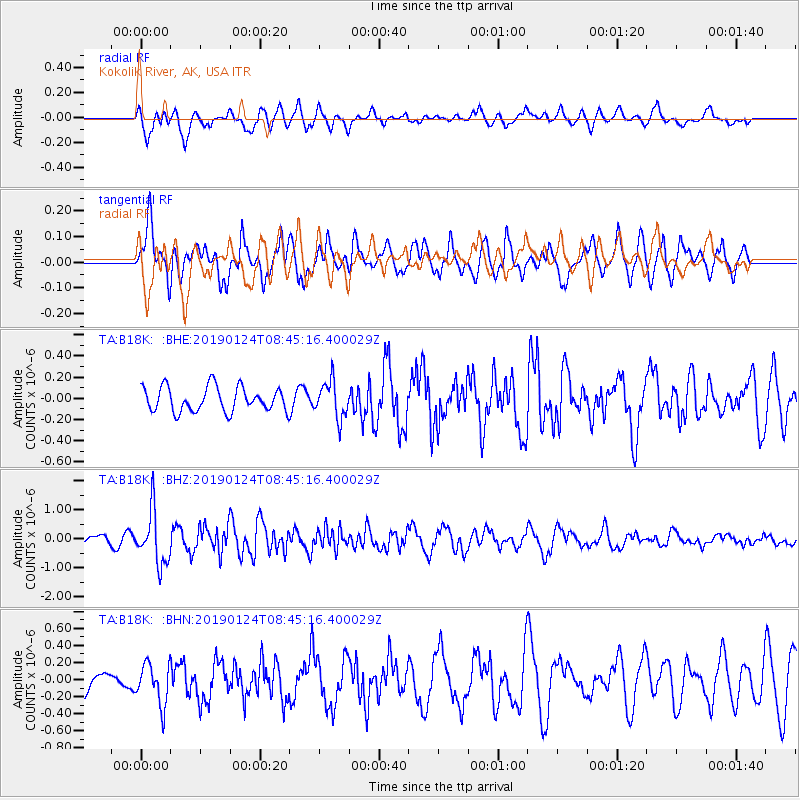
B18K Kokolik River, AK, USA - Earthquake Result Viewer
*The percent match for this event was below the threshold and hence no stack was calculated.
| Earthquake location: |
Philippine Islands Region |
| Earthquake latitude/longitude: |
19.2/121.1 |
| Earthquake time(UTC): |
2019/01/24 (024) 08:34:53 GMT |
| Earthquake Depth: |
23 km |
| Earthquake Magnitude: |
5.5 Mww |
| Earthquake Catalog/Contributor: |
NEIC PDE/us |
|
| Network: |
TA USArray Transportable Network (new EarthScope stations) |
| Station: |
B18K Kokolik River, AK, USA |
| Lat/Lon: |
69.36 N/161.80 W |
| Elevation: |
222 m |
|
| Distance: |
67.6 deg |
| Az: |
21.947 deg |
| Baz: |
264.921 deg |
| Ray Param: |
$rayparam |
*The percent match for this event was below the threshold and hence was not used in the summary stack. |
|
| Radial Match: |
68.71555 % |
| Radial Bump: |
400 |
| Transverse Match: |
69.6454 % |
| Transverse Bump: |
400 |
| SOD ConfigId: |
13570011 |
| Insert Time: |
2019-05-02 09:09:58.543 +0000 |
| GWidth: |
2.5 |
| Max Bumps: |
400 |
| Tol: |
0.001 |
|
Signal To Noise
| Channel | StoN | STA | LTA |
| TA:B18K: :BHZ:20190124T08:45:16.400029Z | 4.72376 | 9.1088356E-7 | 1.9283019E-7 |
| TA:B18K: :BHN:20190124T08:45:16.400029Z | 1.173078 | 2.375293E-7 | 2.0248383E-7 |
| TA:B18K: :BHE:20190124T08:45:16.400029Z | 1.4834492 | 1.7145567E-7 | 1.15579056E-7 |
| Arrivals |
| Ps | |
| PpPs | |
| PsPs/PpSs | |


