You are here: Home > Network List > TA - USArray Transportable Network (new EarthScope stations) Stations List
> Station D25K Kavik River, AK, USA > Earthquake Result Viewer
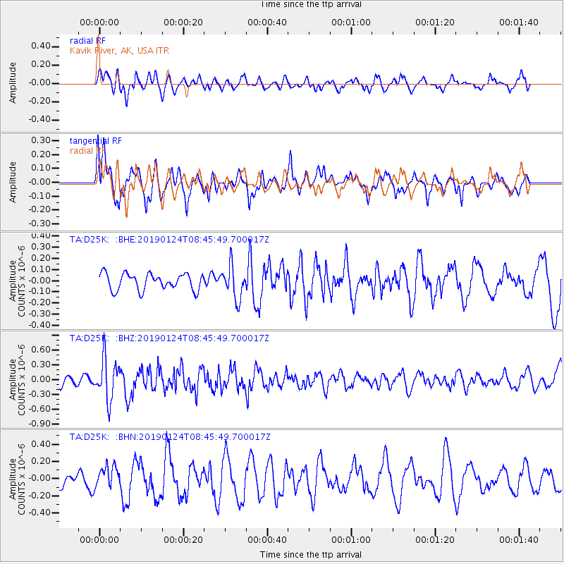
D25K Kavik River, AK, USA - Earthquake Result Viewer
*The percent match for this event was below the threshold and hence no stack was calculated.
| Earthquake location: |
Philippine Islands Region |
| Earthquake latitude/longitude: |
19.2/121.1 |
| Earthquake time(UTC): |
2019/01/24 (024) 08:34:53 GMT |
| Earthquake Depth: |
23 km |
| Earthquake Magnitude: |
5.5 Mww |
| Earthquake Catalog/Contributor: |
NEIC PDE/us |
|
| Network: |
TA USArray Transportable Network (new EarthScope stations) |
| Station: |
D25K Kavik River, AK, USA |
| Lat/Lon: |
69.32 N/146.38 W |
| Elevation: |
770 m |
|
| Distance: |
73.0 deg |
| Az: |
21.778 deg |
| Baz: |
279.297 deg |
| Ray Param: |
$rayparam |
*The percent match for this event was below the threshold and hence was not used in the summary stack. |
|
| Radial Match: |
59.9843 % |
| Radial Bump: |
400 |
| Transverse Match: |
67.66065 % |
| Transverse Bump: |
400 |
| SOD ConfigId: |
13570011 |
| Insert Time: |
2019-05-02 09:10:08.117 +0000 |
| GWidth: |
2.5 |
| Max Bumps: |
400 |
| Tol: |
0.001 |
|
Signal To Noise
| Channel | StoN | STA | LTA |
| TA:D25K: :BHZ:20190124T08:45:49.700017Z | 2.2537673 | 4.2945408E-7 | 1.9054944E-7 |
| TA:D25K: :BHN:20190124T08:45:49.700017Z | 0.8924217 | 1.18985476E-7 | 1.3332875E-7 |
| TA:D25K: :BHE:20190124T08:45:49.700017Z | 2.054343 | 1.505027E-7 | 7.326074E-8 |
| Arrivals |
| Ps | |
| PpPs | |
| PsPs/PpSs | |


