You are here: Home > Network List > TA - USArray Transportable Network (new EarthScope stations) Stations List
> Station G21K Allakaket, AK, USA > Earthquake Result Viewer
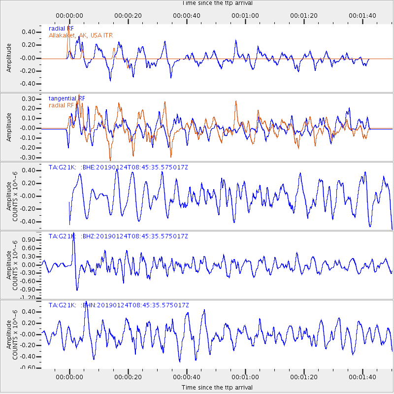
G21K Allakaket, AK, USA - Earthquake Result Viewer
*The percent match for this event was below the threshold and hence no stack was calculated.
| Earthquake location: |
Philippine Islands Region |
| Earthquake latitude/longitude: |
19.2/121.1 |
| Earthquake time(UTC): |
2019/01/24 (024) 08:34:53 GMT |
| Earthquake Depth: |
23 km |
| Earthquake Magnitude: |
5.5 Mww |
| Earthquake Catalog/Contributor: |
NEIC PDE/us |
|
| Network: |
TA USArray Transportable Network (new EarthScope stations) |
| Station: |
G21K Allakaket, AK, USA |
| Lat/Lon: |
66.52 N/153.51 W |
| Elevation: |
446 m |
|
| Distance: |
70.7 deg |
| Az: |
25.042 deg |
| Baz: |
273.71 deg |
| Ray Param: |
$rayparam |
*The percent match for this event was below the threshold and hence was not used in the summary stack. |
|
| Radial Match: |
60.78744 % |
| Radial Bump: |
400 |
| Transverse Match: |
54.043125 % |
| Transverse Bump: |
400 |
| SOD ConfigId: |
13570011 |
| Insert Time: |
2019-05-02 09:10:28.240 +0000 |
| GWidth: |
2.5 |
| Max Bumps: |
400 |
| Tol: |
0.001 |
|
Signal To Noise
| Channel | StoN | STA | LTA |
| TA:G21K: :BHZ:20190124T08:45:35.575017Z | 4.415007 | 4.864078E-7 | 1.1017147E-7 |
| TA:G21K: :BHN:20190124T08:45:35.575017Z | 0.86083955 | 1.0971225E-7 | 1.2744796E-7 |
| TA:G21K: :BHE:20190124T08:45:35.575017Z | 0.90848356 | 1.9380636E-7 | 2.1332951E-7 |
| Arrivals |
| Ps | |
| PpPs | |
| PsPs/PpSs | |


