You are here: Home > Network List > TA - USArray Transportable Network (new EarthScope stations) Stations List
> Station I30M Mount Dempster, Yukon, CAN > Earthquake Result Viewer
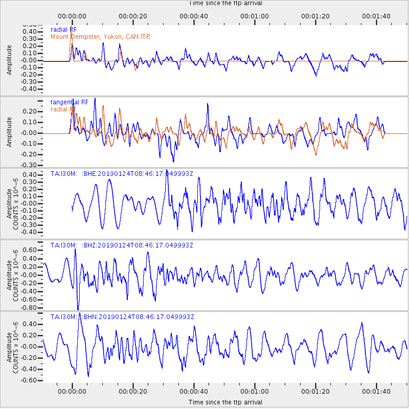
I30M Mount Dempster, Yukon, CAN - Earthquake Result Viewer
*The percent match for this event was below the threshold and hence no stack was calculated.
| Earthquake location: |
Philippine Islands Region |
| Earthquake latitude/longitude: |
19.2/121.1 |
| Earthquake time(UTC): |
2019/01/24 (024) 08:34:53 GMT |
| Earthquake Depth: |
23 km |
| Earthquake Magnitude: |
5.5 Mww |
| Earthquake Catalog/Contributor: |
NEIC PDE/us |
|
| Network: |
TA USArray Transportable Network (new EarthScope stations) |
| Station: |
I30M Mount Dempster, Yukon, CAN |
| Lat/Lon: |
65.22 N/136.38 W |
| Elevation: |
1399 m |
|
| Distance: |
77.8 deg |
| Az: |
24.895 deg |
| Baz: |
289.305 deg |
| Ray Param: |
$rayparam |
*The percent match for this event was below the threshold and hence was not used in the summary stack. |
|
| Radial Match: |
52.786686 % |
| Radial Bump: |
400 |
| Transverse Match: |
69.84655 % |
| Transverse Bump: |
400 |
| SOD ConfigId: |
13570011 |
| Insert Time: |
2019-05-02 09:10:41.017 +0000 |
| GWidth: |
2.5 |
| Max Bumps: |
400 |
| Tol: |
0.001 |
|
Signal To Noise
| Channel | StoN | STA | LTA |
| TA:I30M: :BHZ:20190124T08:46:17.049993Z | 1.776429 | 3.4766092E-7 | 1.9570774E-7 |
| TA:I30M: :BHN:20190124T08:46:17.049993Z | 1.6501938 | 3.4421896E-7 | 2.0859305E-7 |
| TA:I30M: :BHE:20190124T08:46:17.049993Z | 1.2462846 | 2.0734974E-7 | 1.663743E-7 |
| Arrivals |
| Ps | |
| PpPs | |
| PsPs/PpSs | |


