G22A Birney, MT, USA - Earthquake Result Viewer
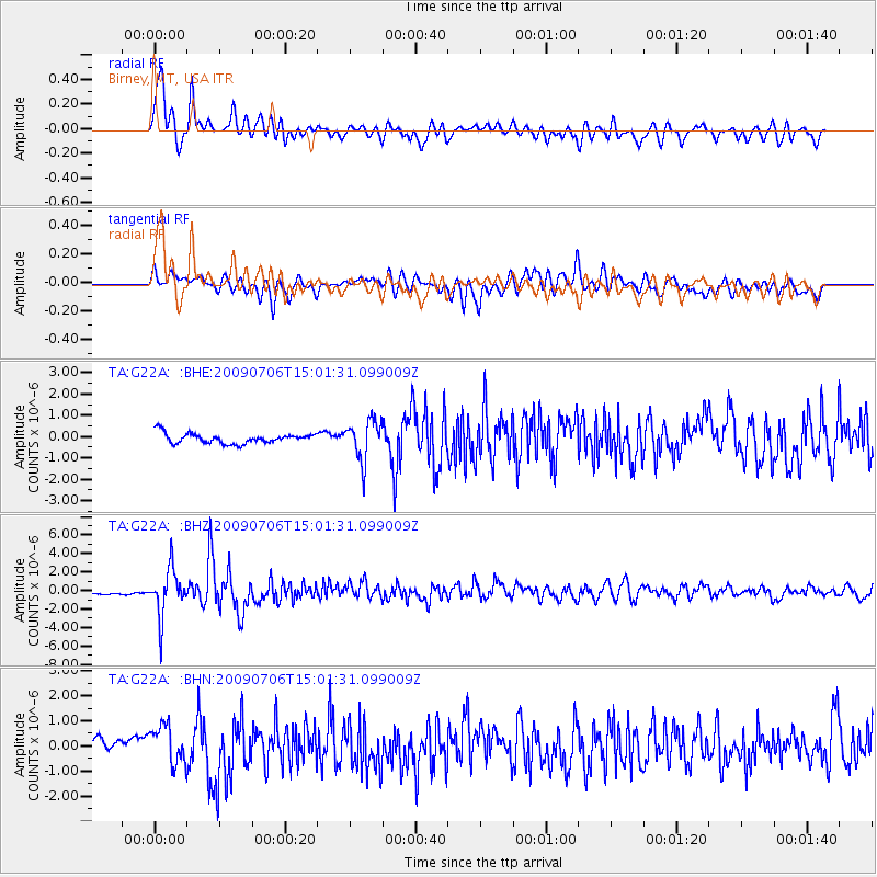
Earthquake location: Rat Islands, Aleutian Islands
Earthquake latitude/longitude: 50.4/177.0
Earthquake time(UTC): 2009/07/06 (187) 14:53:12 GMT
Earthquake Depth: 22 km
Earthquake Magnitude: 6.0 MB, 5.8 MS, 6.1 MW, 6.0 MW
Earthquake Catalog/Contributor: WHDF/NEIC
Network: TA USArray Transportable Network (new EarthScope stations)
Station: G22A Birney, MT, USA
Lat/Lon: 45.22 N/106.29 W
Elevation: 1203 m
Distance: 49.6 deg
Az: 64.538 deg
Baz: 305.223 deg
Ray Param: 0.06854815
Estimated Moho Depth: 34.25 km
Estimated Crust Vp/Vs: 1.99
Assumed Crust Vp: 6.178 km/s
Estimated Crust Vs: 3.105 km/s
Estimated Crust Poisson's Ratio: 0.33
Radial Match: 80.97713 %
Radial Bump: 400
Transverse Match: 70.3937 %
Transverse Bump: 400
SOD ConfigId: 2648
Insert Time: 2010-03-06 19:38:11.657 +0000
GWidth: 2.5
Max Bumps: 400
Tol: 0.001

Signal To Noise

ChannelStoNSTALTA
TA:G22A: :BHZ:20090706T15:01:31.099009Z10.6886462.5020038E-62.340805E-7
TA:G22A: :BHN:20090706T15:01:31.099009Z3.1490837.612557E-72.4173886E-7
TA:G22A: :BHE:20090706T15:01:31.099009Z3.9889929.3329544E-72.3396774E-7
Arrivals
Ps5.8 SECOND
PpPs16 SECOND
PsPs/PpSs22 SECOND