You are here: Home > Network List > TS - TERRAscope (Southern California Seismic Network) Stations List
> Station CALB Calabasas, California, USA > Earthquake Result Viewer
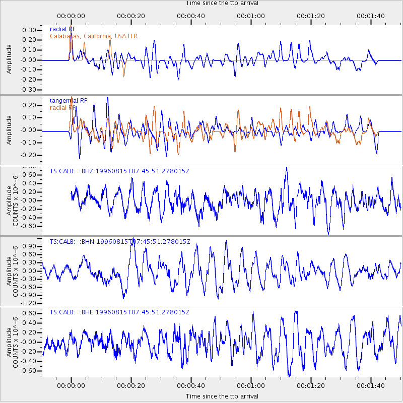
CALB Calabasas, California, USA - Earthquake Result Viewer
*The percent match for this event was below the threshold and hence no stack was calculated.
| Earthquake location: |
Vanuatu Islands |
| Earthquake latitude/longitude: |
-13.3/166.8 |
| Earthquake time(UTC): |
1996/08/15 (228) 07:33:50 GMT |
| Earthquake Depth: |
33 km |
| Earthquake Magnitude: |
5.7 MB, 6.0 MS, 6.3 UNKNOWN, 6.2 MW |
| Earthquake Catalog/Contributor: |
WHDF/NEIC |
|
| Network: |
TS TERRAscope (Southern California Seismic Network) |
| Station: |
CALB Calabasas, California, USA |
| Lat/Lon: |
34.14 N/118.63 W |
| Elevation: |
0.0 m |
|
| Distance: |
85.0 deg |
| Az: |
53.364 deg |
| Baz: |
250.371 deg |
| Ray Param: |
$rayparam |
*The percent match for this event was below the threshold and hence was not used in the summary stack. |
|
| Radial Match: |
60.27043 % |
| Radial Bump: |
400 |
| Transverse Match: |
65.27072 % |
| Transverse Bump: |
400 |
| SOD ConfigId: |
4480 |
| Insert Time: |
2010-02-26 14:04:17.301 +0000 |
| GWidth: |
2.5 |
| Max Bumps: |
400 |
| Tol: |
0.001 |
|
Signal To Noise
| Channel | StoN | STA | LTA |
| TS:CALB: :BHN:19960815T07:45:51.278015Z | 1.9808457 | 2.8980662E-7 | 1.4630449E-7 |
| TS:CALB: :BHE:19960815T07:45:51.278015Z | 0.92456603 | 1.5822226E-7 | 1.7113138E-7 |
| TS:CALB: :BHZ:19960815T07:45:51.278015Z | 1.3730223 | 2.7912935E-7 | 2.0329557E-7 |
| Arrivals |
| Ps | |
| PpPs | |
| PsPs/PpSs | |


