You are here: Home > Network List > TA - USArray Transportable Network (new EarthScope stations) Stations List
> Station G22A Birney, MT, USA > Earthquake Result Viewer
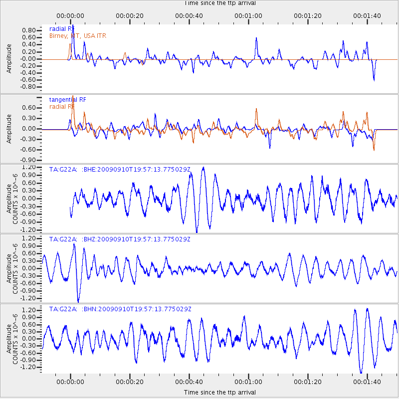
G22A Birney, MT, USA - Earthquake Result Viewer
*The percent match for this event was below the threshold and hence no stack was calculated.
| Earthquake location: |
Easter Island Region |
| Earthquake latitude/longitude: |
-29.9/-111.8 |
| Earthquake time(UTC): |
2009/09/10 (253) 19:46:03 GMT |
| Earthquake Depth: |
10 km |
| Earthquake Magnitude: |
5.5 MW, 5.4 MB |
| Earthquake Catalog/Contributor: |
WHDF/NEIC |
|
| Network: |
TA USArray Transportable Network (new EarthScope stations) |
| Station: |
G22A Birney, MT, USA |
| Lat/Lon: |
45.22 N/106.29 W |
| Elevation: |
1203 m |
|
| Distance: |
75.0 deg |
| Az: |
4.045 deg |
| Baz: |
184.971 deg |
| Ray Param: |
$rayparam |
*The percent match for this event was below the threshold and hence was not used in the summary stack. |
|
| Radial Match: |
66.00312 % |
| Radial Bump: |
400 |
| Transverse Match: |
51.554604 % |
| Transverse Bump: |
400 |
| SOD ConfigId: |
2622 |
| Insert Time: |
2010-03-06 19:38:37.965 +0000 |
| GWidth: |
2.5 |
| Max Bumps: |
400 |
| Tol: |
0.001 |
|
Signal To Noise
| Channel | StoN | STA | LTA |
| TA:G22A: :BHZ:20090910T19:57:13.775029Z | 2.8697426 | 6.9124275E-7 | 2.4087274E-7 |
| TA:G22A: :BHN:20090910T19:57:13.775029Z | 0.59804285 | 3.2545253E-7 | 5.44196E-7 |
| TA:G22A: :BHE:20090910T19:57:13.775029Z | 0.8603613 | 2.4133672E-7 | 2.8050624E-7 |
| Arrivals |
| Ps | |
| PpPs | |
| PsPs/PpSs | |


