You are here: Home > Network List > TA - USArray Transportable Network (new EarthScope stations) Stations List
> Station G22A Birney, MT, USA > Earthquake Result Viewer
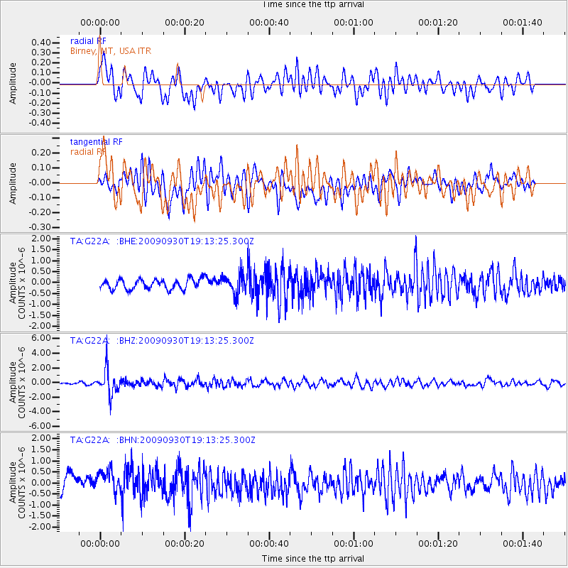
G22A Birney, MT, USA - Earthquake Result Viewer
*The percent match for this event was below the threshold and hence no stack was calculated.
| Earthquake location: |
Peru-Bolivia Border Region |
| Earthquake latitude/longitude: |
-15.6/-69.3 |
| Earthquake time(UTC): |
2009/09/30 (273) 19:03:17 GMT |
| Earthquake Depth: |
255 km |
| Earthquake Magnitude: |
5.9 MB, 5.8 MW |
| Earthquake Catalog/Contributor: |
WHDF/NEIC |
|
| Network: |
TA USArray Transportable Network (new EarthScope stations) |
| Station: |
G22A Birney, MT, USA |
| Lat/Lon: |
45.22 N/106.29 W |
| Elevation: |
1203 m |
|
| Distance: |
69.2 deg |
| Az: |
332.929 deg |
| Baz: |
141.639 deg |
| Ray Param: |
$rayparam |
*The percent match for this event was below the threshold and hence was not used in the summary stack. |
|
| Radial Match: |
68.421875 % |
| Radial Bump: |
400 |
| Transverse Match: |
55.153748 % |
| Transverse Bump: |
400 |
| SOD ConfigId: |
2622 |
| Insert Time: |
2010-03-06 19:38:39.873 +0000 |
| GWidth: |
2.5 |
| Max Bumps: |
400 |
| Tol: |
0.001 |
|
Signal To Noise
| Channel | StoN | STA | LTA |
| TA:G22A: :BHZ:20090930T19:13:25.300Z | 9.890382 | 1.7259962E-6 | 1.7451259E-7 |
| TA:G22A: :BHN:20090930T19:13:25.300Z | 1.7999984 | 5.79471E-7 | 3.2192864E-7 |
| TA:G22A: :BHE:20090930T19:13:25.300Z | 1.9246643 | 4.4586056E-7 | 2.3165627E-7 |
| Arrivals |
| Ps | |
| PpPs | |
| PsPs/PpSs | |


