You are here: Home > Network List > TA - USArray Transportable Network (new EarthScope stations) Stations List
> Station P17K Kvichak River, AK, USA > Earthquake Result Viewer
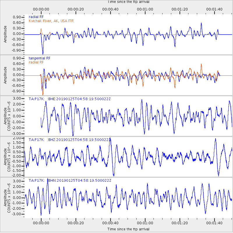
P17K Kvichak River, AK, USA - Earthquake Result Viewer
*The percent match for this event was below the threshold and hence no stack was calculated.
| Earthquake location: |
Near Coast Of Peru |
| Earthquake latitude/longitude: |
-14.5/-75.4 |
| Earthquake time(UTC): |
2019/01/25 (025) 04:45:21 GMT |
| Earthquake Depth: |
57 km |
| Earthquake Magnitude: |
5.6 Mww |
| Earthquake Catalog/Contributor: |
NEIC PDE/us |
|
| Network: |
TA USArray Transportable Network (new EarthScope stations) |
| Station: |
P17K Kvichak River, AK, USA |
| Lat/Lon: |
59.20 N/156.44 W |
| Elevation: |
91 m |
|
| Distance: |
97.8 deg |
| Az: |
329.125 deg |
| Baz: |
105.059 deg |
| Ray Param: |
$rayparam |
*The percent match for this event was below the threshold and hence was not used in the summary stack. |
|
| Radial Match: |
56.78527 % |
| Radial Bump: |
400 |
| Transverse Match: |
58.116737 % |
| Transverse Bump: |
400 |
| SOD ConfigId: |
13570011 |
| Insert Time: |
2019-05-02 09:18:58.043 +0000 |
| GWidth: |
2.5 |
| Max Bumps: |
400 |
| Tol: |
0.001 |
|
Signal To Noise
| Channel | StoN | STA | LTA |
| TA:P17K: :BHZ:20190125T04:58:19.500022Z | 0.70646375 | 4.5726776E-7 | 6.472629E-7 |
| TA:P17K: :BHN:20190125T04:58:19.500022Z | 2.0189695 | 1.870192E-6 | 9.263101E-7 |
| TA:P17K: :BHE:20190125T04:58:19.500022Z | 0.48524392 | 6.885628E-7 | 1.4190035E-6 |
| Arrivals |
| Ps | |
| PpPs | |
| PsPs/PpSs | |


