You are here: Home > Network List > TA - USArray Transportable Network (new EarthScope stations) Stations List
> Station G22A Birney, MT, USA > Earthquake Result Viewer
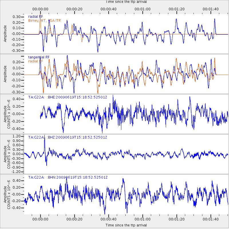
G22A Birney, MT, USA - Earthquake Result Viewer
*The percent match for this event was below the threshold and hence no stack was calculated.
| Earthquake location: |
Mariana Islands |
| Earthquake latitude/longitude: |
14.1/145.2 |
| Earthquake time(UTC): |
2009/06/19 (170) 15:06:24 GMT |
| Earthquake Depth: |
114 km |
| Earthquake Magnitude: |
5.5 MB, 5.5 MW |
| Earthquake Catalog/Contributor: |
WHDF/NEIC |
|
| Network: |
TA USArray Transportable Network (new EarthScope stations) |
| Station: |
G22A Birney, MT, USA |
| Lat/Lon: |
45.22 N/106.29 W |
| Elevation: |
1203 m |
|
| Distance: |
92.7 deg |
| Az: |
42.138 deg |
| Baz: |
292.908 deg |
| Ray Param: |
$rayparam |
*The percent match for this event was below the threshold and hence was not used in the summary stack. |
|
| Radial Match: |
61.222065 % |
| Radial Bump: |
400 |
| Transverse Match: |
65.307274 % |
| Transverse Bump: |
400 |
| SOD ConfigId: |
2648 |
| Insert Time: |
2010-03-06 19:39:04.698 +0000 |
| GWidth: |
2.5 |
| Max Bumps: |
400 |
| Tol: |
0.001 |
|
Signal To Noise
| Channel | StoN | STA | LTA |
| TA:G22A: :BHZ:20090619T15:18:52.52501Z | 2.802983 | 3.3844424E-7 | 1.2074429E-7 |
| TA:G22A: :BHN:20090619T15:18:52.52501Z | 0.9479872 | 1.3605981E-7 | 1.4352494E-7 |
| TA:G22A: :BHE:20090619T15:18:52.52501Z | 0.83911705 | 1.15017905E-7 | 1.3707016E-7 |
| Arrivals |
| Ps | |
| PpPs | |
| PsPs/PpSs | |


