You are here: Home > Network List > WY - Yellowstone Wyoming Seismic Network Stations List
> Station YHR Hawk's Rest, WY, USA > Earthquake Result Viewer
YHR Hawk's Rest, WY, USA - Earthquake Result Viewer
*The percent match for this event was below the threshold and hence no stack was calculated.
| Earthquake location: |
Northern Mid-Atlantic Ridge |
| Earthquake latitude/longitude: |
22.1/-45.9 |
| Earthquake time(UTC): |
2016/09/09 (253) 17:17:54 GMT |
| Earthquake Depth: |
10 km |
| Earthquake Magnitude: |
5.5 MB |
| Earthquake Catalog/Contributor: |
NEIC PDE/NEIC COMCAT |
|
| Network: |
WY Yellowstone Wyoming Seismic Network |
| Station: |
YHR Hawk's Rest, WY, USA |
| Lat/Lon: |
44.11 N/110.08 W |
| Elevation: |
2976 m |
|
| Distance: |
56.6 deg |
| Az: |
309.034 deg |
| Baz: |
90.692 deg |
| Ray Param: |
$rayparam |
*The percent match for this event was below the threshold and hence was not used in the summary stack. |
|
| Radial Match: |
17.56803 % |
| Radial Bump: |
400 |
| Transverse Match: |
17.965155 % |
| Transverse Bump: |
400 |
| SOD ConfigId: |
1634031 |
| Insert Time: |
2016-09-23 17:25:54.345 +0000 |
| GWidth: |
2.5 |
| Max Bumps: |
400 |
| Tol: |
0.001 |
|
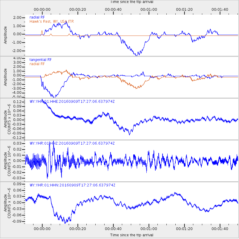
Signal To Noise
| Channel | StoN | STA | LTA |
| WY:YHR:01:HHZ:20160909T17:27:06.637974Z | 2.713632 | 1.3227593E-8 | 4.8744977E-9 |
| WY:YHR:01:HHN:20160909T17:27:06.637974Z | 0.34682846 | 1.0852344E-8 | 3.1290234E-8 |
| WY:YHR:01:HHE:20160909T17:27:06.637974Z | 0.46830565 | 1.751275E-8 | 3.739598E-8 |
| Arrivals |
| Ps | |
| PpPs | |
| PsPs/PpSs | |


