You are here: Home > Network List > TA - USArray Transportable Network (new EarthScope stations) Stations List
> Station A22K Sinclair Lake, AK, USA > Earthquake Result Viewer
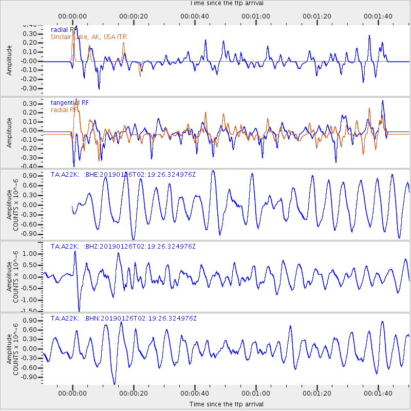
A22K Sinclair Lake, AK, USA - Earthquake Result Viewer
*The percent match for this event was below the threshold and hence no stack was calculated.
| Earthquake location: |
Santa Cruz Islands |
| Earthquake latitude/longitude: |
-10.9/165.9 |
| Earthquake time(UTC): |
2019/01/26 (026) 02:07:23 GMT |
| Earthquake Depth: |
52 km |
| Earthquake Magnitude: |
5.7 Mww |
| Earthquake Catalog/Contributor: |
NEIC PDE/us |
|
| Network: |
TA USArray Transportable Network (new EarthScope stations) |
| Station: |
A22K Sinclair Lake, AK, USA |
| Lat/Lon: |
71.00 N/154.97 W |
| Elevation: |
6.0 m |
|
| Distance: |
85.8 deg |
| Az: |
11.945 deg |
| Baz: |
218.377 deg |
| Ray Param: |
$rayparam |
*The percent match for this event was below the threshold and hence was not used in the summary stack. |
|
| Radial Match: |
70.77257 % |
| Radial Bump: |
352 |
| Transverse Match: |
60.314297 % |
| Transverse Bump: |
400 |
| SOD ConfigId: |
13570011 |
| Insert Time: |
2019-05-02 09:24:43.634 +0000 |
| GWidth: |
2.5 |
| Max Bumps: |
400 |
| Tol: |
0.001 |
|
Signal To Noise
| Channel | StoN | STA | LTA |
| TA:A22K: :BHZ:20190126T02:19:26.324976Z | 3.6127427 | 6.4572794E-7 | 1.7873622E-7 |
| TA:A22K: :BHN:20190126T02:19:26.324976Z | 1.0622855 | 2.8177038E-7 | 2.652492E-7 |
| TA:A22K: :BHE:20190126T02:19:26.324976Z | 0.75534594 | 3.8361685E-7 | 5.078691E-7 |
| Arrivals |
| Ps | |
| PpPs | |
| PsPs/PpSs | |


