You are here: Home > Network List > TA - USArray Transportable Network (new EarthScope stations) Stations List
> Station E20K Nigu River, AK, USA > Earthquake Result Viewer
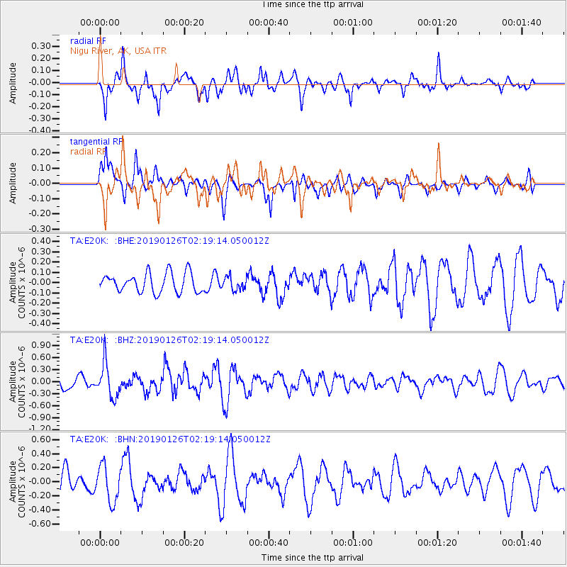
E20K Nigu River, AK, USA - Earthquake Result Viewer
*The percent match for this event was below the threshold and hence no stack was calculated.
| Earthquake location: |
Santa Cruz Islands |
| Earthquake latitude/longitude: |
-10.9/165.9 |
| Earthquake time(UTC): |
2019/01/26 (026) 02:07:23 GMT |
| Earthquake Depth: |
52 km |
| Earthquake Magnitude: |
5.7 Mww |
| Earthquake Catalog/Contributor: |
NEIC PDE/us |
|
| Network: |
TA USArray Transportable Network (new EarthScope stations) |
| Station: |
E20K Nigu River, AK, USA |
| Lat/Lon: |
68.26 N/156.19 W |
| Elevation: |
866 m |
|
| Distance: |
83.4 deg |
| Az: |
13.309 deg |
| Baz: |
217.368 deg |
| Ray Param: |
$rayparam |
*The percent match for this event was below the threshold and hence was not used in the summary stack. |
|
| Radial Match: |
69.5646 % |
| Radial Bump: |
398 |
| Transverse Match: |
69.57835 % |
| Transverse Bump: |
395 |
| SOD ConfigId: |
13570011 |
| Insert Time: |
2019-05-02 09:24:51.862 +0000 |
| GWidth: |
2.5 |
| Max Bumps: |
400 |
| Tol: |
0.001 |
|
Signal To Noise
| Channel | StoN | STA | LTA |
| TA:E20K: :BHZ:20190126T02:19:14.050012Z | 2.8488348 | 4.3635643E-7 | 1.5317015E-7 |
| TA:E20K: :BHN:20190126T02:19:14.050012Z | 1.972947 | 2.623621E-7 | 1.329798E-7 |
| TA:E20K: :BHE:20190126T02:19:14.050012Z | 0.68467724 | 6.410952E-8 | 9.363466E-8 |
| Arrivals |
| Ps | |
| PpPs | |
| PsPs/PpSs | |


