You are here: Home > Network List > TA - USArray Transportable Network (new EarthScope stations) Stations List
> Station G22A Birney, MT, USA > Earthquake Result Viewer
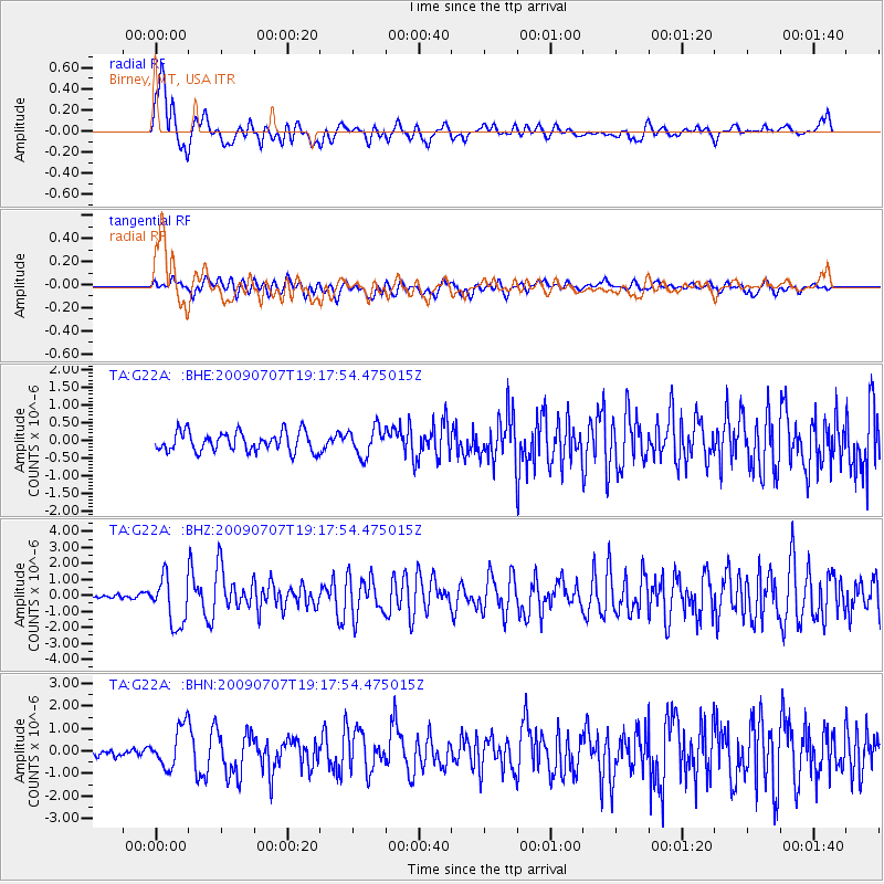
G22A Birney, MT, USA - Earthquake Result Viewer
*The percent match for this event was below the threshold and hence no stack was calculated.
| Earthquake location: |
Baffin Bay |
| Earthquake latitude/longitude: |
75.4/-72.5 |
| Earthquake time(UTC): |
2009/07/07 (188) 19:11:46 GMT |
| Earthquake Depth: |
19 km |
| Earthquake Magnitude: |
5.9 MB, 5.7 MS, 6.1 MW, 6.0 MW |
| Earthquake Catalog/Contributor: |
WHDF/NEIC |
|
| Network: |
TA USArray Transportable Network (new EarthScope stations) |
| Station: |
G22A Birney, MT, USA |
| Lat/Lon: |
45.22 N/106.29 W |
| Elevation: |
1203 m |
|
| Distance: |
33.5 deg |
| Az: |
225.432 deg |
| Baz: |
14.864 deg |
| Ray Param: |
$rayparam |
*The percent match for this event was below the threshold and hence was not used in the summary stack. |
|
| Radial Match: |
76.38623 % |
| Radial Bump: |
400 |
| Transverse Match: |
62.96133 % |
| Transverse Bump: |
400 |
| SOD ConfigId: |
2648 |
| Insert Time: |
2010-03-06 19:39:20.503 +0000 |
| GWidth: |
2.5 |
| Max Bumps: |
400 |
| Tol: |
0.001 |
|
Signal To Noise
| Channel | StoN | STA | LTA |
| TA:G22A: :BHZ:20090707T19:17:54.475015Z | 10.908709 | 1.5058439E-6 | 1.3804053E-7 |
| TA:G22A: :BHN:20090707T19:17:54.475015Z | 3.9353604 | 8.9008853E-7 | 2.2617714E-7 |
| TA:G22A: :BHE:20090707T19:17:54.475015Z | 1.428201 | 3.9527765E-7 | 2.7676612E-7 |
| Arrivals |
| Ps | |
| PpPs | |
| PsPs/PpSs | |


