You are here: Home > Network List > TA - USArray Transportable Network (new EarthScope stations) Stations List
> Station J26L Joseph Creek, AK, USA > Earthquake Result Viewer
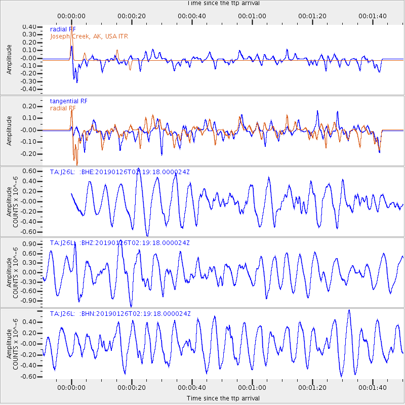
J26L Joseph Creek, AK, USA - Earthquake Result Viewer
*The percent match for this event was below the threshold and hence no stack was calculated.
| Earthquake location: |
Santa Cruz Islands |
| Earthquake latitude/longitude: |
-10.9/165.9 |
| Earthquake time(UTC): |
2019/01/26 (026) 02:07:23 GMT |
| Earthquake Depth: |
52 km |
| Earthquake Magnitude: |
5.7 Mww |
| Earthquake Catalog/Contributor: |
NEIC PDE/us |
|
| Network: |
TA USArray Transportable Network (new EarthScope stations) |
| Station: |
J26L Joseph Creek, AK, USA |
| Lat/Lon: |
64.50 N/143.56 W |
| Elevation: |
1144 m |
|
| Distance: |
84.2 deg |
| Az: |
19.614 deg |
| Baz: |
229.62 deg |
| Ray Param: |
$rayparam |
*The percent match for this event was below the threshold and hence was not used in the summary stack. |
|
| Radial Match: |
55.523273 % |
| Radial Bump: |
400 |
| Transverse Match: |
55.468025 % |
| Transverse Bump: |
400 |
| SOD ConfigId: |
13570011 |
| Insert Time: |
2019-05-02 09:25:07.655 +0000 |
| GWidth: |
2.5 |
| Max Bumps: |
400 |
| Tol: |
0.001 |
|
Signal To Noise
| Channel | StoN | STA | LTA |
| TA:J26L: :BHZ:20190126T02:19:18.000024Z | 2.2403734 | 5.34229E-7 | 2.3845536E-7 |
| TA:J26L: :BHN:20190126T02:19:18.000024Z | 0.68929535 | 1.5104995E-7 | 2.1913675E-7 |
| TA:J26L: :BHE:20190126T02:19:18.000024Z | 1.162485 | 3.3247133E-7 | 2.8600053E-7 |
| Arrivals |
| Ps | |
| PpPs | |
| PsPs/PpSs | |


