You are here: Home > Network List > UW - Pacific Northwest Regional Seismic Network Stations List
> Station UMAT Pilot Rock, OR, USA > Earthquake Result Viewer
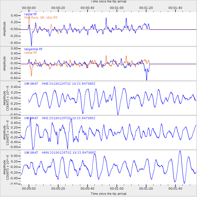
UMAT Pilot Rock, OR, USA - Earthquake Result Viewer
*The percent match for this event was below the threshold and hence no stack was calculated.
| Earthquake location: |
Santa Cruz Islands |
| Earthquake latitude/longitude: |
-10.9/165.9 |
| Earthquake time(UTC): |
2019/01/26 (026) 02:07:23 GMT |
| Earthquake Depth: |
52 km |
| Earthquake Magnitude: |
5.7 Mww |
| Earthquake Catalog/Contributor: |
NEIC PDE/us |
|
| Network: |
UW Pacific Northwest Regional Seismic Network |
| Station: |
UMAT Pilot Rock, OR, USA |
| Lat/Lon: |
45.29 N/118.96 W |
| Elevation: |
1318 m |
|
| Distance: |
87.4 deg |
| Az: |
43.066 deg |
| Baz: |
251.845 deg |
| Ray Param: |
$rayparam |
*The percent match for this event was below the threshold and hence was not used in the summary stack. |
|
| Radial Match: |
67.59898 % |
| Radial Bump: |
399 |
| Transverse Match: |
77.01991 % |
| Transverse Bump: |
400 |
| SOD ConfigId: |
13570011 |
| Insert Time: |
2019-05-02 09:26:07.038 +0000 |
| GWidth: |
2.5 |
| Max Bumps: |
400 |
| Tol: |
0.001 |
|
Signal To Noise
| Channel | StoN | STA | LTA |
| UW:UMAT: :HHZ:20190126T02:19:33.847986Z | 3.088755 | 4.1292085E-7 | 1.3368522E-7 |
| UW:UMAT: :HHN:20190126T02:19:33.847986Z | 1.2037944 | 1.3383138E-7 | 1.11174614E-7 |
| UW:UMAT: :HHE:20190126T02:19:33.847986Z | 0.80015403 | 1.4438905E-7 | 1.8045156E-7 |
| Arrivals |
| Ps | |
| PpPs | |
| PsPs/PpSs | |


