G23A Biddle, MT, USA - Earthquake Result Viewer
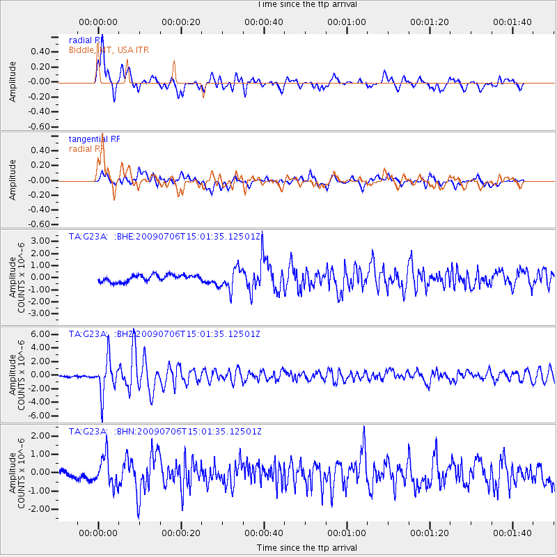
Earthquake location: Rat Islands, Aleutian Islands
Earthquake latitude/longitude: 50.4/177.0
Earthquake time(UTC): 2009/07/06 (187) 14:53:12 GMT
Earthquake Depth: 22 km
Earthquake Magnitude: 6.0 MB, 5.8 MS, 6.1 MW, 6.0 MW
Earthquake Catalog/Contributor: WHDF/NEIC
Network: TA USArray Transportable Network (new EarthScope stations)
Station: G23A Biddle, MT, USA
Lat/Lon: 45.20 N/105.39 W
Elevation: 1064 m
Distance: 50.2 deg
Az: 64.074 deg
Baz: 305.562 deg
Ray Param: 0.068211086
Estimated Moho Depth: 17.75 km
Estimated Crust Vp/Vs: 1.80
Assumed Crust Vp: 6.242 km/s
Estimated Crust Vs: 3.468 km/s
Estimated Crust Poisson's Ratio: 0.28
Radial Match: 82.91232 %
Radial Bump: 400
Transverse Match: 65.915886 %
Transverse Bump: 400
SOD ConfigId: 2648
Insert Time: 2010-03-06 19:39:53.478 +0000
GWidth: 2.5
Max Bumps: 400
Tol: 0.001

Signal To Noise

ChannelStoNSTALTA
TA:G23A: :BHZ:20090706T15:01:35.12501Z16.990132.639586E-61.5535997E-7
TA:G23A: :BHN:20090706T15:01:35.12501Z3.0686067.9793375E-72.6003136E-7
TA:G23A: :BHE:20090706T15:01:35.12501Z3.19884948.8579253E-72.7690973E-7
Arrivals
Ps2.4 SECOND
PpPs7.5 SECOND
PsPs/PpSs9.9 SECOND