You are here: Home > Network List > TA - USArray Transportable Network (new EarthScope stations) Stations List
> Station G23A Biddle, MT, USA > Earthquake Result Viewer
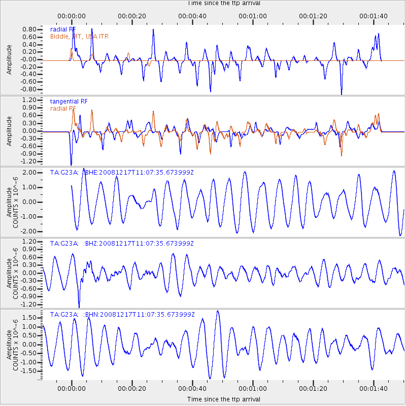
G23A Biddle, MT, USA - Earthquake Result Viewer
*The percent match for this event was below the threshold and hence no stack was calculated.
| Earthquake location: |
Fiji Islands Region |
| Earthquake latitude/longitude: |
-17.7/-178.4 |
| Earthquake time(UTC): |
2008/12/17 (352) 10:55:59 GMT |
| Earthquake Depth: |
530 km |
| Earthquake Magnitude: |
5.8 MW, 5.2 MB, 5.8 MW |
| Earthquake Catalog/Contributor: |
WHDF/NEIC |
|
| Network: |
TA USArray Transportable Network (new EarthScope stations) |
| Station: |
G23A Biddle, MT, USA |
| Lat/Lon: |
45.20 N/105.39 W |
| Elevation: |
1064 m |
|
| Distance: |
91.0 deg |
| Az: |
42.542 deg |
| Baz: |
245.701 deg |
| Ray Param: |
$rayparam |
*The percent match for this event was below the threshold and hence was not used in the summary stack. |
|
| Radial Match: |
69.222885 % |
| Radial Bump: |
333 |
| Transverse Match: |
55.208073 % |
| Transverse Bump: |
400 |
| SOD ConfigId: |
2658 |
| Insert Time: |
2010-03-06 19:40:51.484 +0000 |
| GWidth: |
2.5 |
| Max Bumps: |
400 |
| Tol: |
0.001 |
|
Signal To Noise
| Channel | StoN | STA | LTA |
| TA:G23A: :BHZ:20081217T11:07:35.673999Z | 1.9155167 | 5.2041776E-7 | 2.716853E-7 |
| TA:G23A: :BHN:20081217T11:07:35.673999Z | 1.9691371 | 1.0768364E-6 | 5.46857E-7 |
| TA:G23A: :BHE:20081217T11:07:35.673999Z | 1.0811597 | 1.0860186E-6 | 1.0044942E-6 |
| Arrivals |
| Ps | |
| PpPs | |
| PsPs/PpSs | |


