You are here: Home > Network List > TA - USArray Transportable Network (new EarthScope stations) Stations List
> Station A21K Barrow, AK, USA > Earthquake Result Viewer
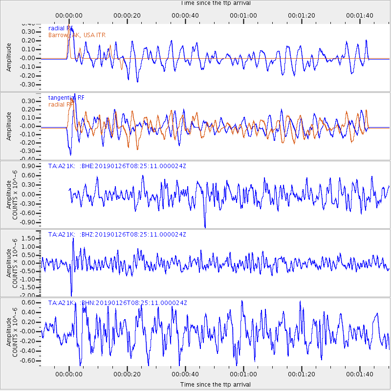
A21K Barrow, AK, USA - Earthquake Result Viewer
*The percent match for this event was below the threshold and hence no stack was calculated.
| Earthquake location: |
Aru Islands Region, Indonesia |
| Earthquake latitude/longitude: |
-5.5/133.8 |
| Earthquake time(UTC): |
2019/01/26 (026) 08:12:48 GMT |
| Earthquake Depth: |
10 km |
| Earthquake Magnitude: |
5.8 Mww |
| Earthquake Catalog/Contributor: |
NEIC PDE/us |
|
| Network: |
TA USArray Transportable Network (new EarthScope stations) |
| Station: |
A21K Barrow, AK, USA |
| Lat/Lon: |
71.32 N/156.62 W |
| Elevation: |
577 m |
|
| Distance: |
88.8 deg |
| Az: |
17.583 deg |
| Baz: |
248.967 deg |
| Ray Param: |
$rayparam |
*The percent match for this event was below the threshold and hence was not used in the summary stack. |
|
| Radial Match: |
56.5545 % |
| Radial Bump: |
400 |
| Transverse Match: |
56.03127 % |
| Transverse Bump: |
400 |
| SOD ConfigId: |
13570011 |
| Insert Time: |
2019-05-02 09:37:17.897 +0000 |
| GWidth: |
2.5 |
| Max Bumps: |
400 |
| Tol: |
0.001 |
|
Signal To Noise
| Channel | StoN | STA | LTA |
| TA:A21K: :BHZ:20190126T08:25:11.000024Z | 2.9011035 | 6.8921537E-7 | 2.3757006E-7 |
| TA:A21K: :BHN:20190126T08:25:11.000024Z | 1.7456936 | 3.3738553E-7 | 1.9326733E-7 |
| TA:A21K: :BHE:20190126T08:25:11.000024Z | 1.4448596 | 2.6310303E-7 | 1.8209592E-7 |
| Arrivals |
| Ps | |
| PpPs | |
| PsPs/PpSs | |


