You are here: Home > Network List > AV - Alaska Volcano Observatory Stations List
> Station SPCR Ckakachatna River, Mount Spurr, Alaska > Earthquake Result Viewer
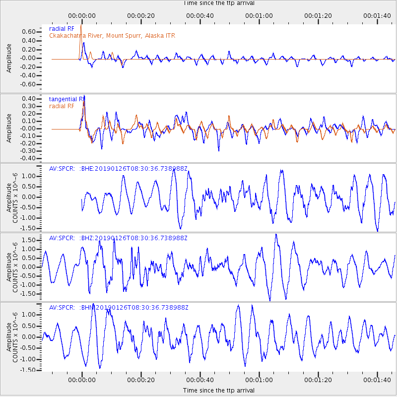
SPCR Ckakachatna River, Mount Spurr, Alaska - Earthquake Result Viewer
*The percent match for this event was below the threshold and hence no stack was calculated.
| Earthquake location: |
Near East Coast Of Honshu, Japan |
| Earthquake latitude/longitude: |
40.3/142.2 |
| Earthquake time(UTC): |
2019/01/26 (026) 08:23:02 GMT |
| Earthquake Depth: |
37 km |
| Earthquake Magnitude: |
5.5 Mww |
| Earthquake Catalog/Contributor: |
NEIC PDE/us |
|
| Network: |
AV Alaska Volcano Observatory |
| Station: |
SPCR Ckakachatna River, Mount Spurr, Alaska |
| Lat/Lon: |
61.20 N/152.21 W |
| Elevation: |
984 m |
|
| Distance: |
44.2 deg |
| Az: |
39.25 deg |
| Baz: |
272.957 deg |
| Ray Param: |
$rayparam |
*The percent match for this event was below the threshold and hence was not used in the summary stack. |
|
| Radial Match: |
63.601887 % |
| Radial Bump: |
400 |
| Transverse Match: |
70.30353 % |
| Transverse Bump: |
400 |
| SOD ConfigId: |
13570011 |
| Insert Time: |
2019-05-02 09:40:46.432 +0000 |
| GWidth: |
2.5 |
| Max Bumps: |
400 |
| Tol: |
0.001 |
|
Signal To Noise
| Channel | StoN | STA | LTA |
| AV:SPCR: :BHZ:20190126T08:30:36.738988Z | 1.9782133 | 7.990812E-7 | 4.0394087E-7 |
| AV:SPCR: :BHN:20190126T08:30:36.738988Z | 2.1676507 | 9.208505E-7 | 4.2481497E-7 |
| AV:SPCR: :BHE:20190126T08:30:36.738988Z | 2.083096 | 9.5330535E-7 | 4.5763872E-7 |
| Arrivals |
| Ps | |
| PpPs | |
| PsPs/PpSs | |


