You are here: Home > Network List > TA - USArray Transportable Network (new EarthScope stations) Stations List
> Station P26A Davis Ranch, Arriba, CO, USA > Earthquake Result Viewer
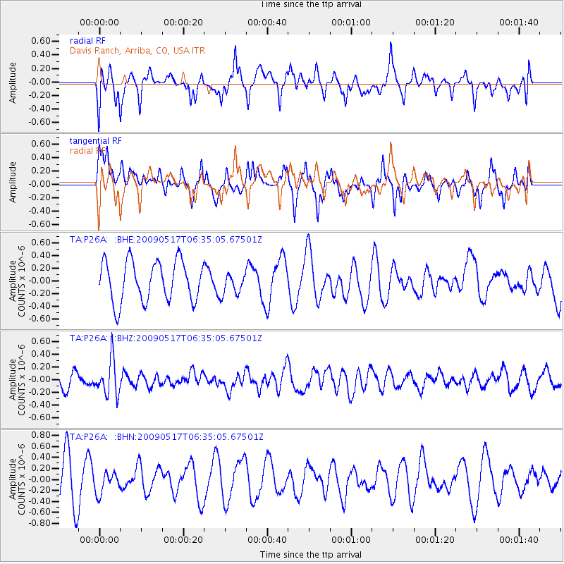
P26A Davis Ranch, Arriba, CO, USA - Earthquake Result Viewer
*The percent match for this event was below the threshold and hence no stack was calculated.
| Earthquake location: |
Tonga Islands |
| Earthquake latitude/longitude: |
-16.8/-173.5 |
| Earthquake time(UTC): |
2009/05/17 (137) 06:23:03 GMT |
| Earthquake Depth: |
67 km |
| Earthquake Magnitude: |
5.5 MB, 5.6 MW, 5.6 MW |
| Earthquake Catalog/Contributor: |
WHDF/NEIC |
|
| Network: |
TA USArray Transportable Network (new EarthScope stations) |
| Station: |
P26A Davis Ranch, Arriba, CO, USA |
| Lat/Lon: |
39.56 N/103.35 W |
| Elevation: |
1566 m |
|
| Distance: |
86.0 deg |
| Az: |
46.788 deg |
| Baz: |
244.548 deg |
| Ray Param: |
$rayparam |
*The percent match for this event was below the threshold and hence was not used in the summary stack. |
|
| Radial Match: |
58.16174 % |
| Radial Bump: |
400 |
| Transverse Match: |
53.467873 % |
| Transverse Bump: |
385 |
| SOD ConfigId: |
2760 |
| Insert Time: |
2010-03-06 19:41:48.949 +0000 |
| GWidth: |
2.5 |
| Max Bumps: |
400 |
| Tol: |
0.001 |
|
Signal To Noise
| Channel | StoN | STA | LTA |
| TA:P26A: :BHZ:20090517T06:35:05.67501Z | 2.2065353 | 2.8604143E-7 | 1.2963375E-7 |
| TA:P26A: :BHN:20090517T06:35:05.67501Z | 0.58274543 | 1.9539824E-7 | 3.3530637E-7 |
| TA:P26A: :BHE:20090517T06:35:05.67501Z | 0.505499 | 1.6116027E-7 | 3.1881424E-7 |
| Arrivals |
| Ps | |
| PpPs | |
| PsPs/PpSs | |


