You are here: Home > Network List > TA - USArray Transportable Network (new EarthScope stations) Stations List
> Station P26A Davis Ranch, Arriba, CO, USA > Earthquake Result Viewer
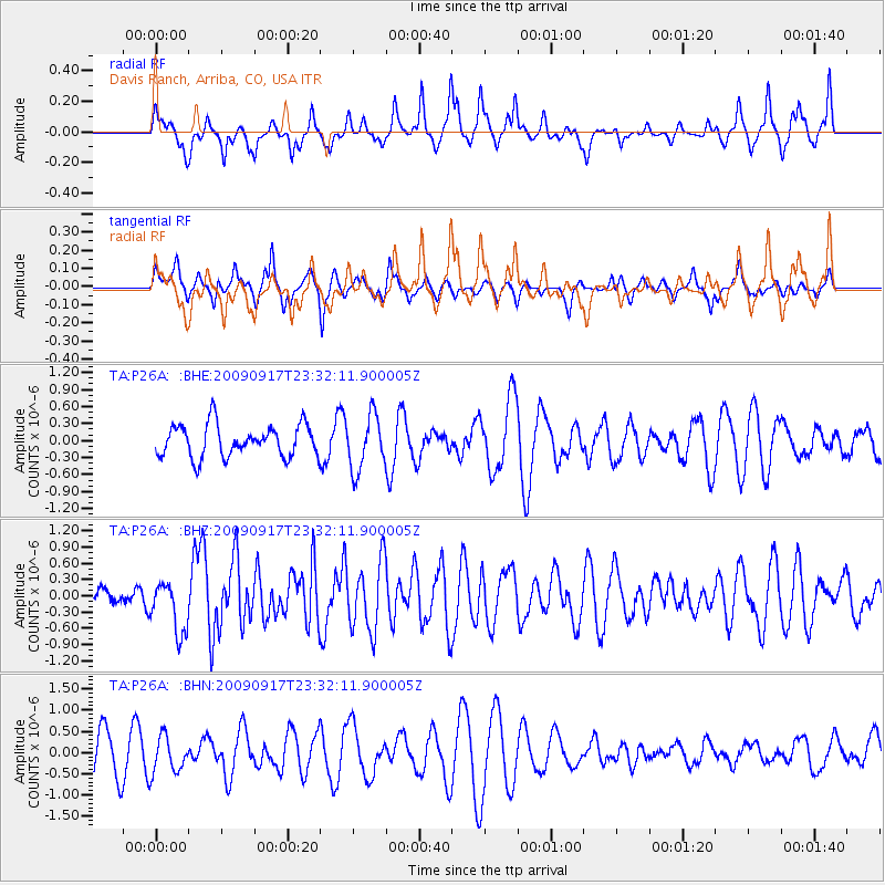
P26A Davis Ranch, Arriba, CO, USA - Earthquake Result Viewer
*The percent match for this event was below the threshold and hence no stack was calculated.
| Earthquake location: |
Easter Island Region |
| Earthquake latitude/longitude: |
-29.1/-112.3 |
| Earthquake time(UTC): |
2009/09/17 (260) 23:21:38 GMT |
| Earthquake Depth: |
10 km |
| Earthquake Magnitude: |
5.7 MB, 6.0 MS, 6.2 MW, 6.2 MW |
| Earthquake Catalog/Contributor: |
WHDF/NEIC |
|
| Network: |
TA USArray Transportable Network (new EarthScope stations) |
| Station: |
P26A Davis Ranch, Arriba, CO, USA |
| Lat/Lon: |
39.56 N/103.35 W |
| Elevation: |
1566 m |
|
| Distance: |
68.9 deg |
| Az: |
7.384 deg |
| Baz: |
188.363 deg |
| Ray Param: |
$rayparam |
*The percent match for this event was below the threshold and hence was not used in the summary stack. |
|
| Radial Match: |
52.10317 % |
| Radial Bump: |
350 |
| Transverse Match: |
49.502205 % |
| Transverse Bump: |
374 |
| SOD ConfigId: |
2622 |
| Insert Time: |
2010-03-06 19:42:08.144 +0000 |
| GWidth: |
2.5 |
| Max Bumps: |
400 |
| Tol: |
0.001 |
|
Signal To Noise
| Channel | StoN | STA | LTA |
| TA:P26A: :BHZ:20090917T23:32:11.900005Z | 1.9118993 | 4.774106E-7 | 2.4970487E-7 |
| TA:P26A: :BHN:20090917T23:32:11.900005Z | 0.5444187 | 4.2330865E-7 | 7.775425E-7 |
| TA:P26A: :BHE:20090917T23:32:11.900005Z | 1.7025335 | 4.791286E-7 | 2.8142094E-7 |
| Arrivals |
| Ps | |
| PpPs | |
| PsPs/PpSs | |


