You are here: Home > Network List > TA - USArray Transportable Network (new EarthScope stations) Stations List
> Station P26A Davis Ranch, Arriba, CO, USA > Earthquake Result Viewer
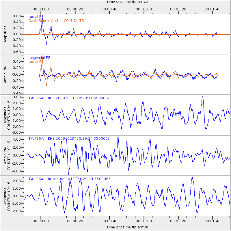
P26A Davis Ranch, Arriba, CO, USA - Earthquake Result Viewer
*The percent match for this event was below the threshold and hence no stack was calculated.
| Earthquake location: |
Fox Islands, Aleutian Islands |
| Earthquake latitude/longitude: |
52.6/-167.1 |
| Earthquake time(UTC): |
2009/10/13 (286) 20:21:53 GMT |
| Earthquake Depth: |
14 km |
| Earthquake Magnitude: |
5.9 MB, 6.4 MS, 6.4 MW, 6.4 MW |
| Earthquake Catalog/Contributor: |
WHDF/NEIC |
|
| Network: |
TA USArray Transportable Network (new EarthScope stations) |
| Station: |
P26A Davis Ranch, Arriba, CO, USA |
| Lat/Lon: |
39.56 N/103.35 W |
| Elevation: |
1566 m |
|
| Distance: |
44.7 deg |
| Az: |
80.493 deg |
| Baz: |
308.912 deg |
| Ray Param: |
$rayparam |
*The percent match for this event was below the threshold and hence was not used in the summary stack. |
|
| Radial Match: |
72.099754 % |
| Radial Bump: |
257 |
| Transverse Match: |
62.718082 % |
| Transverse Bump: |
326 |
| SOD ConfigId: |
2622 |
| Insert Time: |
2010-03-06 19:42:14.806 +0000 |
| GWidth: |
2.5 |
| Max Bumps: |
400 |
| Tol: |
0.001 |
|
Signal To Noise
| Channel | StoN | STA | LTA |
| TA:P26A: :BHZ:20091013T20:29:34.550006Z | 3.1559663 | 6.7759794E-7 | 2.1470379E-7 |
| TA:P26A: :BHN:20091013T20:29:34.550006Z | 1.0989599 | 7.151959E-7 | 6.5079337E-7 |
| TA:P26A: :BHE:20091013T20:29:34.550006Z | 1.671602 | 1.0471646E-6 | 6.2644375E-7 |
| Arrivals |
| Ps | |
| PpPs | |
| PsPs/PpSs | |


