You are here: Home > Network List > AV - Alaska Volcano Observatory Stations List
> Station PLBL Mt. Peulik Volcano, Alaska > Earthquake Result Viewer
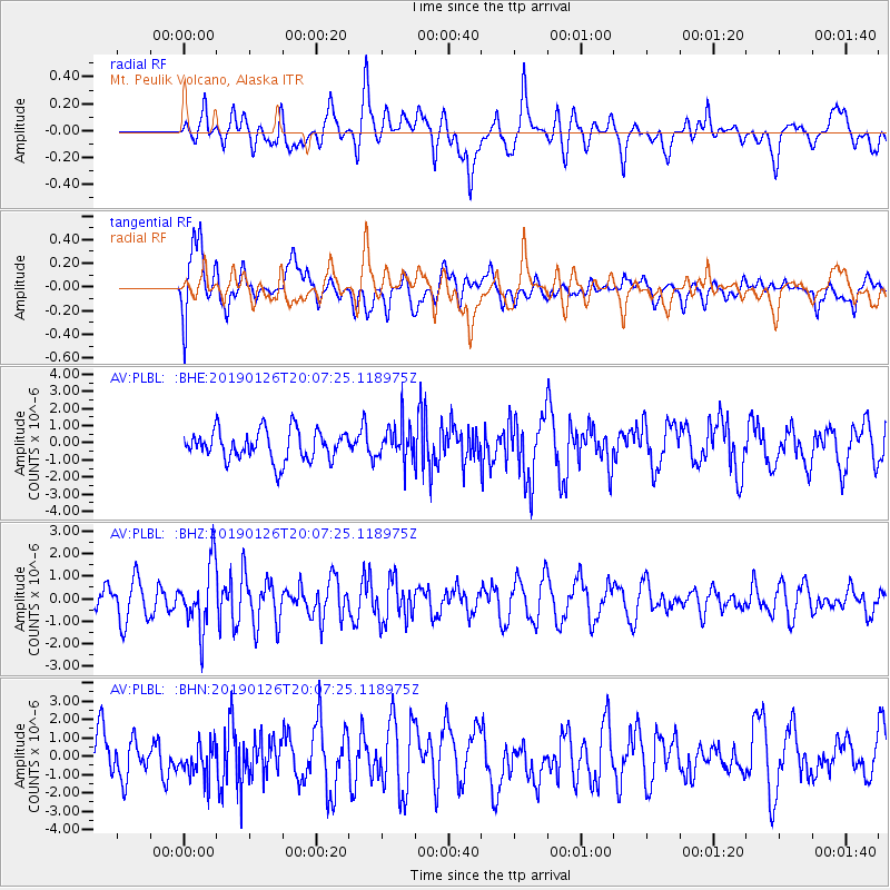
PLBL Mt. Peulik Volcano, Alaska - Earthquake Result Viewer
*The percent match for this event was below the threshold and hence no stack was calculated.
| Earthquake location: |
Fiji Islands Region |
| Earthquake latitude/longitude: |
-21.1/-178.9 |
| Earthquake time(UTC): |
2019/01/26 (026) 19:56:42 GMT |
| Earthquake Depth: |
579 km |
| Earthquake Magnitude: |
6.2 Mww |
| Earthquake Catalog/Contributor: |
NEIC PDE/us |
|
| Network: |
AV Alaska Volcano Observatory |
| Station: |
PLBL Mt. Peulik Volcano, Alaska |
| Lat/Lon: |
57.70 N/156.82 W |
| Elevation: |
461 m |
|
| Distance: |
80.7 deg |
| Az: |
11.782 deg |
| Baz: |
200.794 deg |
| Ray Param: |
$rayparam |
*The percent match for this event was below the threshold and hence was not used in the summary stack. |
|
| Radial Match: |
58.238056 % |
| Radial Bump: |
400 |
| Transverse Match: |
55.876812 % |
| Transverse Bump: |
400 |
| SOD ConfigId: |
13570011 |
| Insert Time: |
2019-05-02 10:00:31.070 +0000 |
| GWidth: |
2.5 |
| Max Bumps: |
400 |
| Tol: |
0.001 |
|
Signal To Noise
| Channel | StoN | STA | LTA |
| AV:PLBL: :BHZ:20190126T20:07:25.118975Z | 2.0132208 | 1.4405409E-6 | 7.155404E-7 |
| AV:PLBL: :BHN:20190126T20:07:25.118975Z | 0.97755945 | 9.249838E-7 | 9.462174E-7 |
| AV:PLBL: :BHE:20190126T20:07:25.118975Z | 1.2123581 | 1.0609907E-6 | 8.7514627E-7 |
| Arrivals |
| Ps | |
| PpPs | |
| PsPs/PpSs | |


