You are here: Home > Network List > CI - Caltech Regional Seismic Network Stations List
> Station MPM Manuel Prospect Mine, California, USA > Earthquake Result Viewer
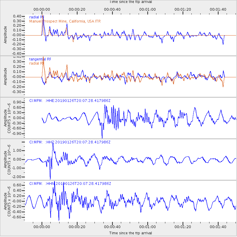
MPM Manuel Prospect Mine, California, USA - Earthquake Result Viewer
*The percent match for this event was below the threshold and hence no stack was calculated.
| Earthquake location: |
Fiji Islands Region |
| Earthquake latitude/longitude: |
-21.1/-178.9 |
| Earthquake time(UTC): |
2019/01/26 (026) 19:56:42 GMT |
| Earthquake Depth: |
579 km |
| Earthquake Magnitude: |
6.2 Mww |
| Earthquake Catalog/Contributor: |
NEIC PDE/us |
|
| Network: |
CI Caltech Regional Seismic Network |
| Station: |
MPM Manuel Prospect Mine, California, USA |
| Lat/Lon: |
36.06 N/117.49 W |
| Elevation: |
185 m |
|
| Distance: |
81.2 deg |
| Az: |
46.025 deg |
| Baz: |
236.003 deg |
| Ray Param: |
$rayparam |
*The percent match for this event was below the threshold and hence was not used in the summary stack. |
|
| Radial Match: |
62.656853 % |
| Radial Bump: |
400 |
| Transverse Match: |
62.398777 % |
| Transverse Bump: |
400 |
| SOD ConfigId: |
13570011 |
| Insert Time: |
2019-05-02 10:02:11.034 +0000 |
| GWidth: |
2.5 |
| Max Bumps: |
400 |
| Tol: |
0.001 |
|
Signal To Noise
| Channel | StoN | STA | LTA |
| CI:MPM: :HHZ:20190126T20:07:28.417986Z | 2.8053691 | 5.7935506E-7 | 2.0651652E-7 |
| CI:MPM: :HHN:20190126T20:07:28.417986Z | 1.416839 | 1.5943473E-7 | 1.12528475E-7 |
| CI:MPM: :HHE:20190126T20:07:28.417986Z | 2.4714394 | 3.2238057E-7 | 1.3044243E-7 |
| Arrivals |
| Ps | |
| PpPs | |
| PsPs/PpSs | |


