You are here: Home > Network List > TA - USArray Transportable Network (new EarthScope stations) Stations List
> Station A21K Barrow, AK, USA > Earthquake Result Viewer
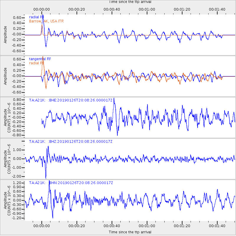
A21K Barrow, AK, USA - Earthquake Result Viewer
*The percent match for this event was below the threshold and hence no stack was calculated.
| Earthquake location: |
Fiji Islands Region |
| Earthquake latitude/longitude: |
-21.1/-178.9 |
| Earthquake time(UTC): |
2019/01/26 (026) 19:56:42 GMT |
| Earthquake Depth: |
579 km |
| Earthquake Magnitude: |
6.2 Mww |
| Earthquake Catalog/Contributor: |
NEIC PDE/us |
|
| Network: |
TA USArray Transportable Network (new EarthScope stations) |
| Station: |
A21K Barrow, AK, USA |
| Lat/Lon: |
71.32 N/156.62 W |
| Elevation: |
577 m |
|
| Distance: |
93.5 deg |
| Az: |
7.019 deg |
| Baz: |
200.735 deg |
| Ray Param: |
$rayparam |
*The percent match for this event was below the threshold and hence was not used in the summary stack. |
|
| Radial Match: |
74.29542 % |
| Radial Bump: |
400 |
| Transverse Match: |
65.41516 % |
| Transverse Bump: |
400 |
| SOD ConfigId: |
13570011 |
| Insert Time: |
2019-05-02 10:05:16.919 +0000 |
| GWidth: |
2.5 |
| Max Bumps: |
400 |
| Tol: |
0.001 |
|
Signal To Noise
| Channel | StoN | STA | LTA |
| TA:A21K: :BHZ:20190126T20:08:26.000017Z | 4.4212866 | 7.617481E-7 | 1.7229105E-7 |
| TA:A21K: :BHN:20190126T20:08:26.000017Z | 2.2661896 | 4.6786727E-7 | 2.0645548E-7 |
| TA:A21K: :BHE:20190126T20:08:26.000017Z | 1.4564275 | 2.342926E-7 | 1.6086803E-7 |
| Arrivals |
| Ps | |
| PpPs | |
| PsPs/PpSs | |


