You are here: Home > Network List > TS - TERRAscope (Southern California Seismic Network) Stations List
> Station CALB Calabasas, California, USA > Earthquake Result Viewer
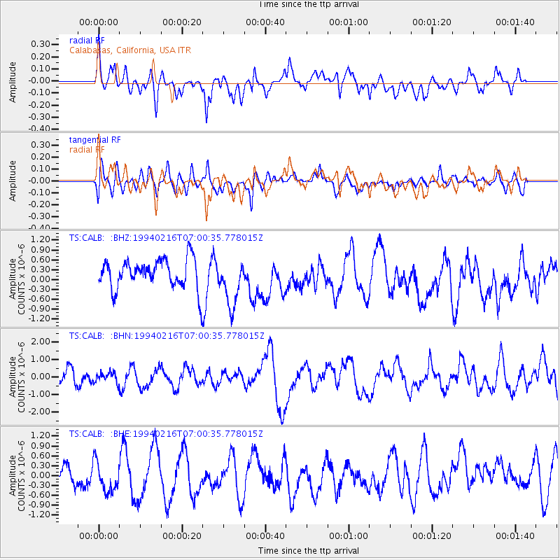
CALB Calabasas, California, USA - Earthquake Result Viewer
*The percent match for this event was below the threshold and hence no stack was calculated.
| Earthquake location: |
Vanuatu Islands |
| Earthquake latitude/longitude: |
-19.9/169.0 |
| Earthquake time(UTC): |
1994/02/16 (047) 06:48:23 GMT |
| Earthquake Depth: |
33 km |
| Earthquake Magnitude: |
5.5 MB |
| Earthquake Catalog/Contributor: |
WHDF/NEIC |
|
| Network: |
TS TERRAscope (Southern California Seismic Network) |
| Station: |
CALB Calabasas, California, USA |
| Lat/Lon: |
34.14 N/118.63 W |
| Elevation: |
0.0 m |
|
| Distance: |
87.3 deg |
| Az: |
52.324 deg |
| Baz: |
243.889 deg |
| Ray Param: |
$rayparam |
*The percent match for this event was below the threshold and hence was not used in the summary stack. |
|
| Radial Match: |
57.7802 % |
| Radial Bump: |
400 |
| Transverse Match: |
42.42827 % |
| Transverse Bump: |
400 |
| SOD ConfigId: |
4480 |
| Insert Time: |
2010-02-26 14:04:37.182 +0000 |
| GWidth: |
2.5 |
| Max Bumps: |
400 |
| Tol: |
0.001 |
|
Signal To Noise
| Channel | StoN | STA | LTA |
| TS:CALB: :BHN:19940216T07:00:35.778015Z | 0.6127738 | 2.8301494E-7 | 4.618588E-7 |
| TS:CALB: :BHE:19940216T07:00:35.778015Z | 1.5173047 | 4.6290188E-7 | 3.0508173E-7 |
| TS:CALB: :BHZ:19940216T07:00:35.778015Z | 1.6630715 | 7.4661426E-7 | 4.4893696E-7 |
| Arrivals |
| Ps | |
| PpPs | |
| PsPs/PpSs | |


