You are here: Home > Network List > TS - TERRAscope (Southern California Seismic Network) Stations List
> Station CALB Calabasas, California, USA > Earthquake Result Viewer
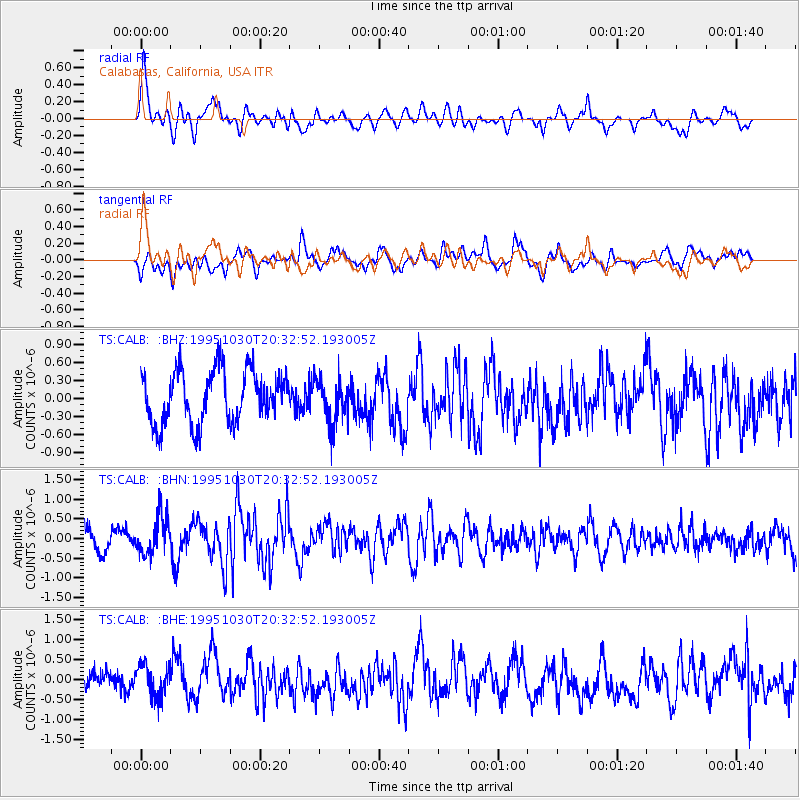
CALB Calabasas, California, USA - Earthquake Result Viewer
*The percent match for this event was below the threshold and hence no stack was calculated.
| Earthquake location: |
Andreanof Islands, Aleutian Is. |
| Earthquake latitude/longitude: |
51.7/-173.4 |
| Earthquake time(UTC): |
1995/10/30 (303) 20:25:28 GMT |
| Earthquake Depth: |
33 km |
| Earthquake Magnitude: |
5.4 MB, 5.3 MS, 5.8 UNKNOWN, 5.6 ML |
| Earthquake Catalog/Contributor: |
WHDF/NEIC |
|
| Network: |
TS TERRAscope (Southern California Seismic Network) |
| Station: |
CALB Calabasas, California, USA |
| Lat/Lon: |
34.14 N/118.63 W |
| Elevation: |
0.0 m |
|
| Distance: |
42.7 deg |
| Az: |
92.216 deg |
| Baz: |
311.408 deg |
| Ray Param: |
$rayparam |
*The percent match for this event was below the threshold and hence was not used in the summary stack. |
|
| Radial Match: |
56.367123 % |
| Radial Bump: |
400 |
| Transverse Match: |
55.226513 % |
| Transverse Bump: |
400 |
| SOD ConfigId: |
4480 |
| Insert Time: |
2010-02-26 14:04:40.236 +0000 |
| GWidth: |
2.5 |
| Max Bumps: |
400 |
| Tol: |
0.001 |
|
Signal To Noise
| Channel | StoN | STA | LTA |
| TS:CALB: :BHN:19951030T20:32:52.193005Z | 1.588023 | 4.6082383E-7 | 2.9018713E-7 |
| TS:CALB: :BHE:19951030T20:32:52.193005Z | 0.66095155 | 4.111434E-7 | 6.220477E-7 |
| TS:CALB: :BHZ:19951030T20:32:52.193005Z | 0.8712262 | 3.7636602E-7 | 4.3199574E-7 |
| Arrivals |
| Ps | |
| PpPs | |
| PsPs/PpSs | |


