You are here: Home > Network List > TA - USArray Transportable Network (new EarthScope stations) Stations List
> Station R32K Eaglecrest, AK, USA > Earthquake Result Viewer
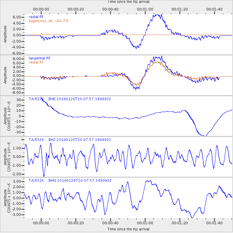
R32K Eaglecrest, AK, USA - Earthquake Result Viewer
*The percent match for this event was below the threshold and hence no stack was calculated.
| Earthquake location: |
Fiji Islands Region |
| Earthquake latitude/longitude: |
-21.1/-178.9 |
| Earthquake time(UTC): |
2019/01/26 (026) 19:56:42 GMT |
| Earthquake Depth: |
579 km |
| Earthquake Magnitude: |
6.2 Mww |
| Earthquake Catalog/Contributor: |
NEIC PDE/us |
|
| Network: |
TA USArray Transportable Network (new EarthScope stations) |
| Station: |
R32K Eaglecrest, AK, USA |
| Lat/Lon: |
58.27 N/134.52 W |
| Elevation: |
386 m |
|
| Distance: |
87.2 deg |
| Az: |
21.701 deg |
| Baz: |
220.787 deg |
| Ray Param: |
$rayparam |
*The percent match for this event was below the threshold and hence was not used in the summary stack. |
|
| Radial Match: |
39.4874 % |
| Radial Bump: |
400 |
| Transverse Match: |
39.566017 % |
| Transverse Bump: |
400 |
| SOD ConfigId: |
13570011 |
| Insert Time: |
2019-05-02 10:07:04.214 +0000 |
| GWidth: |
2.5 |
| Max Bumps: |
400 |
| Tol: |
0.001 |
|
Signal To Noise
| Channel | StoN | STA | LTA |
| TA:R32K: :BHZ:20190126T20:07:57.349993Z | 1.7466439 | 1.1076727E-6 | 6.34172E-7 |
| TA:R32K: :BHN:20190126T20:07:57.349993Z | 0.8523488 | 1.3040717E-6 | 1.5299743E-6 |
| TA:R32K: :BHE:20190126T20:07:57.349993Z | 0.9092728 | 9.503313E-6 | 1.0451554E-5 |
| Arrivals |
| Ps | |
| PpPs | |
| PsPs/PpSs | |


