You are here: Home > Network List > US - United States National Seismic Network Stations List
> Station DGMT Dagmar, Montana, USA > Earthquake Result Viewer
DGMT Dagmar, Montana, USA - Earthquake Result Viewer
*The percent match for this event was below the threshold and hence no stack was calculated.
| Earthquake location: |
Northern Peru |
| Earthquake latitude/longitude: |
-5.6/-77.0 |
| Earthquake time(UTC): |
2016/09/10 (254) 10:08:20 GMT |
| Earthquake Depth: |
114 km |
| Earthquake Magnitude: |
6.0 MB |
| Earthquake Catalog/Contributor: |
NEIC PDE/NEIC ALERT |
|
| Network: |
US United States National Seismic Network |
| Station: |
DGMT Dagmar, Montana, USA |
| Lat/Lon: |
48.47 N/104.20 W |
| Elevation: |
0.0 m |
|
| Distance: |
58.9 deg |
| Az: |
339.163 deg |
| Baz: |
147.86 deg |
| Ray Param: |
$rayparam |
*The percent match for this event was below the threshold and hence was not used in the summary stack. |
|
| Radial Match: |
81.70927 % |
| Radial Bump: |
335 |
| Transverse Match: |
59.685287 % |
| Transverse Bump: |
400 |
| SOD ConfigId: |
1634031 |
| Insert Time: |
2016-09-24 10:16:22.771 +0000 |
| GWidth: |
2.5 |
| Max Bumps: |
400 |
| Tol: |
0.001 |
|
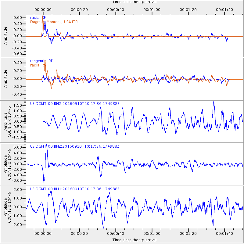
Signal To Noise
| Channel | StoN | STA | LTA |
| US:DGMT:00:BHZ:20160910T10:17:36.174988Z | 14.534642 | 3.5393368E-6 | 2.435104E-7 |
| US:DGMT:00:BH1:20160910T10:17:36.174988Z | 3.820526 | 1.3051928E-6 | 3.4162647E-7 |
| US:DGMT:00:BH2:20160910T10:17:36.174988Z | 1.6015472 | 7.317176E-7 | 4.5688165E-7 |
| Arrivals |
| Ps | |
| PpPs | |
| PsPs/PpSs | |


