You are here: Home > Network List > US - United States National Seismic Network Stations List
> Station HAWA Hanford, Washington, USA > Earthquake Result Viewer
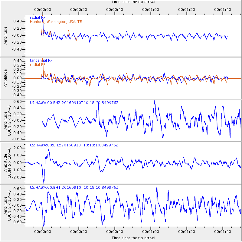
HAWA Hanford, Washington, USA - Earthquake Result Viewer
*The percent match for this event was below the threshold and hence no stack was calculated.
| Earthquake location: |
Northern Peru |
| Earthquake latitude/longitude: |
-5.6/-77.0 |
| Earthquake time(UTC): |
2016/09/10 (254) 10:08:20 GMT |
| Earthquake Depth: |
114 km |
| Earthquake Magnitude: |
6.0 MB |
| Earthquake Catalog/Contributor: |
NEIC PDE/NEIC ALERT |
|
| Network: |
US United States National Seismic Network |
| Station: |
HAWA Hanford, Washington, USA |
| Lat/Lon: |
46.39 N/119.53 W |
| Elevation: |
364 m |
|
| Distance: |
64.0 deg |
| Az: |
328.62 deg |
| Baz: |
131.513 deg |
| Ray Param: |
$rayparam |
*The percent match for this event was below the threshold and hence was not used in the summary stack. |
|
| Radial Match: |
77.79623 % |
| Radial Bump: |
400 |
| Transverse Match: |
68.91892 % |
| Transverse Bump: |
400 |
| SOD ConfigId: |
1634031 |
| Insert Time: |
2016-09-24 10:16:57.320 +0000 |
| GWidth: |
2.5 |
| Max Bumps: |
400 |
| Tol: |
0.001 |
|
Signal To Noise
| Channel | StoN | STA | LTA |
| US:HAWA:00:BHZ:20160910T10:18:10.849976Z | 8.666542 | 1.3070049E-6 | 1.5081044E-7 |
| US:HAWA:00:BH1:20160910T10:18:10.849976Z | 3.748607 | 3.8821418E-7 | 1.0356225E-7 |
| US:HAWA:00:BH2:20160910T10:18:10.849976Z | 2.6517487 | 2.77387E-7 | 1.0460531E-7 |
| Arrivals |
| Ps | |
| PpPs | |
| PsPs/PpSs | |


