You are here: Home > Network List > TA - USArray Transportable Network (new EarthScope stations) Stations List
> Station D25K Kavik River, AK, USA > Earthquake Result Viewer
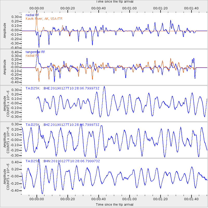
D25K Kavik River, AK, USA - Earthquake Result Viewer
*The percent match for this event was below the threshold and hence no stack was calculated.
| Earthquake location: |
Fiji Islands Region |
| Earthquake latitude/longitude: |
-20.1/-177.8 |
| Earthquake time(UTC): |
2019/01/27 (027) 10:16:27 GMT |
| Earthquake Depth: |
550 km |
| Earthquake Magnitude: |
5.8 Mww |
| Earthquake Catalog/Contributor: |
NEIC PDE/us |
|
| Network: |
TA USArray Transportable Network (new EarthScope stations) |
| Station: |
D25K Kavik River, AK, USA |
| Lat/Lon: |
69.32 N/146.38 W |
| Elevation: |
770 m |
|
| Distance: |
92.0 deg |
| Az: |
10.68 deg |
| Baz: |
209.36 deg |
| Ray Param: |
$rayparam |
*The percent match for this event was below the threshold and hence was not used in the summary stack. |
|
| Radial Match: |
60.67192 % |
| Radial Bump: |
273 |
| Transverse Match: |
48.717094 % |
| Transverse Bump: |
318 |
| SOD ConfigId: |
13570011 |
| Insert Time: |
2019-05-02 10:14:13.221 +0000 |
| GWidth: |
2.5 |
| Max Bumps: |
400 |
| Tol: |
0.001 |
|
Signal To Noise
| Channel | StoN | STA | LTA |
| TA:D25K: :BHZ:20190127T10:28:06.799973Z | 0.88774174 | 1.4045355E-7 | 1.5821443E-7 |
| TA:D25K: :BHN:20190127T10:28:06.799973Z | 1.9020678 | 3.0969088E-7 | 1.62818E-7 |
| TA:D25K: :BHE:20190127T10:28:06.799973Z | 0.56176704 | 6.085446E-8 | 1.08326866E-7 |
| Arrivals |
| Ps | |
| PpPs | |
| PsPs/PpSs | |


