You are here: Home > Network List > TA - USArray Transportable Network (new EarthScope stations) Stations List
> Station T25A Trinidad, CO, USA > Earthquake Result Viewer
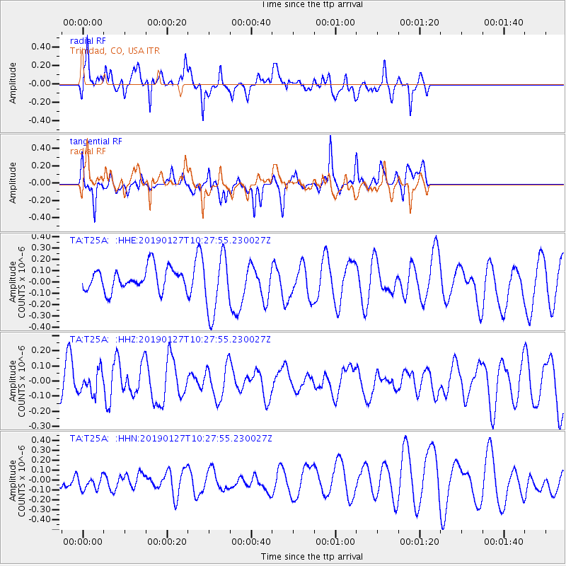
T25A Trinidad, CO, USA - Earthquake Result Viewer
*The percent match for this event was below the threshold and hence no stack was calculated.
| Earthquake location: |
Fiji Islands Region |
| Earthquake latitude/longitude: |
-20.1/-177.8 |
| Earthquake time(UTC): |
2019/01/27 (027) 10:16:27 GMT |
| Earthquake Depth: |
550 km |
| Earthquake Magnitude: |
5.8 Mww |
| Earthquake Catalog/Contributor: |
NEIC PDE/us |
|
| Network: |
TA USArray Transportable Network (new EarthScope stations) |
| Station: |
T25A Trinidad, CO, USA |
| Lat/Lon: |
37.14 N/104.41 W |
| Elevation: |
2017 m |
|
| Distance: |
89.5 deg |
| Az: |
49.98 deg |
| Baz: |
244.228 deg |
| Ray Param: |
$rayparam |
*The percent match for this event was below the threshold and hence was not used in the summary stack. |
|
| Radial Match: |
67.309685 % |
| Radial Bump: |
400 |
| Transverse Match: |
46.792183 % |
| Transverse Bump: |
352 |
| SOD ConfigId: |
13570011 |
| Insert Time: |
2019-05-02 10:14:44.022 +0000 |
| GWidth: |
2.5 |
| Max Bumps: |
400 |
| Tol: |
0.001 |
|
Signal To Noise
| Channel | StoN | STA | LTA |
| TA:T25A: :HHZ:20190127T10:27:55.230027Z | 0.6550634 | 7.4551416E-8 | 1.1380794E-7 |
| TA:T25A: :HHN:20190127T10:27:55.230027Z | 1.1532723 | 8.871543E-8 | 7.692497E-8 |
| TA:T25A: :HHE:20190127T10:27:55.230027Z | 2.709203 | 2.6373664E-7 | 9.7348426E-8 |
| Arrivals |
| Ps | |
| PpPs | |
| PsPs/PpSs | |


